La Bretenière, Jura
La Bretenière | |
|---|---|
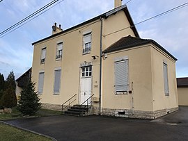 The town hall in La Bretenière | |
 Coat of arms | |
show Location of La Bretenière | |
 La Bretenière | |
| Coordinates: 47°07′47″N 5°39′39″E / 47.1297°N 5.6608°ECoordinates: 47°07′47″N 5°39′39″E / 47.1297°N 5.6608°E | |
| Country | France |
| Region | Bourgogne-Franche-Comté |
| Department | Jura |
| Arrondissement | Dole |
| Canton | Mont-sous-Vaudrey |
| Government | |
| • Mayor (2020–2026) | Isabelle Guillot |
| Area 1 | 1.63 km2 (0.63 sq mi) |
| Population (Jan. 2018)[1] | 221 |
| • Density | 140/km2 (350/sq mi) |
| Time zone | UTC+01:00 (CET) |
| • Summer (DST) | UTC+02:00 (CEST) |
| INSEE/Postal code | 39076 /39700 |
| Elevation | 208–257 m (682–843 ft) |
| 1 French Land Register data, which excludes lakes, ponds, glaciers > 1 km2 (0.386 sq mi or 247 acres) and river estuaries. | |


La Bretenière (French pronunciation: [la bʁətnjɛʁ]) is a commune in the Jura department in Bourgogne-Franche-Comté in eastern France.
Population[]
| Year | Pop. | ±% |
|---|---|---|
| 1962 | 108 | — |
| 1968 | 115 | +6.5% |
| 1975 | 99 | −13.9% |
| 1982 | 126 | +27.3% |
| 1990 | 137 | +8.7% |
| 1999 | 165 | +20.4% |
| 2006 | 186 | +12.7% |
| 2009 | 196 | +5.4% |
See also[]
References[]
- ^ "Populations légales 2018". INSEE. 28 December 2020.
| Wikimedia Commons has media related to La Bretenière (Jura). |
This Jura geographical article is a stub. You can help Wikipedia by . |
Categories:
- Communes of Jura (department)
- Jura (department) geography stubs