Aromas, Jura
Aromas | |
|---|---|
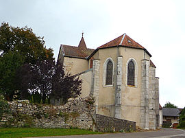 The church in Aromas | |
Location of Aromas  | |
 Aromas | |
| Coordinates: 46°17′36″N 5°28′53″E / 46.2933°N 5.4814°ECoordinates: 46°17′36″N 5°28′53″E / 46.2933°N 5.4814°E | |
| Country | France |
| Region | Bourgogne-Franche-Comté |
| Department | Jura |
| Arrondissement | Lons-le-Saunier |
| Canton | Moirans-en-Montagne |
| Government | |
| • Mayor (2020–2026) | Evelyne Rozek[1] |
| Area 1 | 25.80 km2 (9.96 sq mi) |
| Population (Jan. 2018)[2] | 658 |
| • Density | 26/km2 (66/sq mi) |
| Time zone | UTC+01:00 (CET) |
| • Summer (DST) | UTC+02:00 (CEST) |
| INSEE/Postal code | 39018 /39240 |
| Elevation | 390–660 m (1,280–2,170 ft) |
| 1 French Land Register data, which excludes lakes, ponds, glaciers > 1 km2 (0.386 sq mi or 247 acres) and river estuaries. | |


Aromas is a commune in the Jura department in the region of Bourgogne-Franche-Comté in eastern France. On 1 January 2017, the former commune of Villeneuve-lès-Charnod was merged into Aromas.[3]
Population[]
|
|
See also[]
References[]
- ^ "Répertoire national des élus: les maires". data.gouv.fr, Plateforme ouverte des données publiques françaises (in French). 9 August 2021.
- ^ "Populations légales 2018". The National Institute of Statistics and Economic Studies. 28 December 2020.
- ^ Arrêté préfectoral 15 December 2016 (in French)
| Wikimedia Commons has media related to Aromas. |
| Prefecture |
|
|---|---|
| Subprefectures |
|
| Other |
|
This Jura geographical article is a stub. You can help Wikipedia by . |
Categories:
- Communes of Jura (department)
- Jura (department) geography stubs