Bouée
Bouée | |
|---|---|
Commune | |
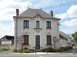 Town hall | |
show Location of Bouée | |
 Bouée | |
| Coordinates: 47°19′18″N 1°54′31″W / 47.3217°N 1.9086°WCoordinates: 47°19′18″N 1°54′31″W / 47.3217°N 1.9086°W | |
| Country | France |
| Region | Pays de la Loire |
| Department | Loire-Atlantique |
| Arrondissement | Saint-Nazaire |
| Canton | Blain |
| Intercommunality | Estuaire et Sillon |
| Government | |
| • Mayor (2020–2026) | André Leborgne |
| Area 1 | 21.34 km2 (8.24 sq mi) |
| Population (Jan. 2018)[1] | 997 |
| • Density | 47/km2 (120/sq mi) |
| Time zone | UTC+01:00 (CET) |
| • Summer (DST) | UTC+02:00 (CEST) |
| INSEE/Postal code | 44019 /44260 |
| Elevation | 0–28 m (0–92 ft) |
| 1 French Land Register data, which excludes lakes, ponds, glaciers > 1 km2 (0.386 sq mi or 247 acres) and river estuaries. | |


Bouée (French pronunciation: [bwe] (![]() listen); Breton: Bozeg) is a commune in the Loire-Atlantique department in western France.
listen); Breton: Bozeg) is a commune in the Loire-Atlantique department in western France.
Population[]
|
|
See also[]
- Communes of the Loire-Atlantique department
References[]
- ^ "Populations légales 2018". INSEE. 28 December 2020.
| Wikimedia Commons has media related to Bouée (Loire-Atlantique). |
This Loire-Atlantique geographical article is a stub. You can help Wikipedia by . |
Categories:
- Communes of Loire-Atlantique
- Loire-Atlantique geography stubs