Montrelais
Montrelais | |
|---|---|
Commune | |
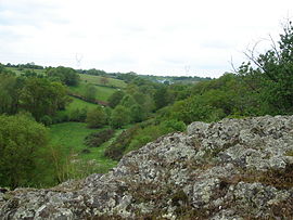 Valley of Bray Creek | |
 Coat of arms | |
show Location of Montrelais | |
 Montrelais | |
| Coordinates: 47°23′23″N 0°57′55″W / 47.3897°N 0.9653°WCoordinates: 47°23′23″N 0°57′55″W / 47.3897°N 0.9653°W | |
| Country | France |
| Region | Pays de la Loire |
| Department | Loire-Atlantique |
| Arrondissement | Châteaubriant-Ancenis |
| Canton | Ancenis |
| Intercommunality | Pays d'Ancenis |
| Government | |
| • Mayor (2020–2026) | Joël Jamin |
| Area 1 | 13.73 km2 (5.30 sq mi) |
| Population (Jan. 2018)[1] | 844 |
| • Density | 61/km2 (160/sq mi) |
| Time zone | UTC+01:00 (CET) |
| • Summer (DST) | UTC+02:00 (CEST) |
| INSEE/Postal code | 44104 /44370 |
| Elevation | 7–62 m (23–203 ft) |
| 1 French Land Register data, which excludes lakes, ponds, glaciers > 1 km2 (0.386 sq mi or 247 acres) and river estuaries. | |


Montrelais is a commune in the Loire-Atlantique department in western France.
Population[]
| Year | Pop. | ±% |
|---|---|---|
| 1793 | 2,780 | — |
| 1806 | 2,550 | −8.3% |
| 1821 | 2,515 | −1.4% |
| 1831 | 2,480 | −1.4% |
| 1841 | 2,257 | −9.0% |
| 1851 | 2,159 | −4.3% |
| 1861 | 1,976 | −8.5% |
| 1872 | 1,960 | ���0.8% |
| 1881 | 1,845 | −5.9% |
| 1891 | 1,636 | −11.3% |
| 1901 | 1,646 | +0.6% |
| 1911 | 797 | −51.6% |
| 1921 | 671 | −15.8% |
| 1931 | 657 | −2.1% |
| 1946 | 593 | −9.7% |
| 1954 | 598 | +0.8% |
| 1962 | 558 | −6.7% |
| 1968 | 514 | −7.9% |
| 1975 | 541 | +5.3% |
| 1982 | 587 | +8.5% |
| 1990 | 587 | +0.0% |
| 1999 | 664 | +13.1% |
| 2008 | 827 | +24.5% |
| 2017 | 852 | +3.0% |
See also[]
- Communes of the Loire-Atlantique department
References[]
- ^ "Populations légales 2018". INSEE. 28 December 2020.
| Wikimedia Commons has media related to Montrelais. |
| show Authority control |
|---|
This Loire-Atlantique geographical article is a stub. You can help Wikipedia by . |
Categories:
- Communes of Loire-Atlantique
- Loire-Atlantique geography stubs