Thouaré-sur-Loire
Thouaré-sur-Loire | |
|---|---|
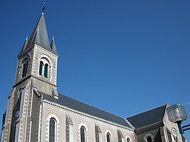 The church of Saint-Vincent | |
 Coat of arms | |
show Location of Thouaré-sur-Loire | |
 Thouaré-sur-Loire | |
| Coordinates: 47°16′06″N 1°26′22″W / 47.2683°N 1.4394°WCoordinates: 47°16′06″N 1°26′22″W / 47.2683°N 1.4394°W | |
| Country | France |
| Region | Pays de la Loire |
| Department | Loire-Atlantique |
| Arrondissement | Nantes |
| Canton | Carquefou |
| Intercommunality | Nantes Métropole |
| Government | |
| • Mayor (2020–2026) | Martine Oger |
| Area 1 | 12.76 km2 (4.93 sq mi) |
| Population (Jan. 2018)[1] | 10,261 |
| • Density | 800/km2 (2,100/sq mi) |
| Time zone | UTC+01:00 (CET) |
| • Summer (DST) | UTC+02:00 (CEST) |
| INSEE/Postal code | 44204 /44470 |
| Elevation | 1–73 m (3.3–239.5 ft) (avg. 13 m or 43 ft) |
| 1 French Land Register data, which excludes lakes, ponds, glaciers > 1 km2 (0.386 sq mi or 247 acres) and river estuaries. | |


Thouaré-sur-Loire (French pronunciation: [twaʁe syʁ lwaʁ] (![]() listen), literally Thouaré on Loire; Breton: Tarvieg) is a commune in the Loire-Atlantique department in western France.
listen), literally Thouaré on Loire; Breton: Tarvieg) is a commune in the Loire-Atlantique department in western France.
Origin of the name[]
The origins of Thouaré are not certain. According to certain hypotheses, the foundation of the city was due to a Roman legionnaire by the name of Taurus or Tauraicus, who had been given a rich villa in the area. Another is that it is due to a Celtic god, worshipped in this part of Gaul, by the name of .
The name of Thouaré appears for the first time in the chart of Louis the Fat in 1123. Its orthography differs due to successive editors: Thoaré, Thoyré, Touaré, Thoaret, Thoairé, then finally Thouaré.
See also[]
- Communes of the Loire-Atlantique department
References[]
- ^ "Populations légales 2018". INSEE. 28 December 2020.
| Wikimedia Commons has media related to Thouaré-sur-Loire. |
| show Authority control |
|---|
This Loire-Atlantique geographical article is a stub. You can help Wikipedia by . |
- Communes of Loire-Atlantique
- Loire-Atlantique geography stubs