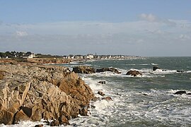
Le Croisic
Le Croisic
Ar Groazig | |
|---|---|
Commune | |
 | |
 Coat of arms | |
show Location of Le Croisic | |
 Le Croisic | |
| Coordinates: 47°17′38″N 2°30′33″W / 47.2939°N 2.5092°WCoordinates: 47°17′38″N 2°30′33″W / 47.2939°N 2.5092°W | |
| Country | France |
| Region | Pays de la Loire |
| Department | Loire-Atlantique |
| Arrondissement | Saint-Nazaire |
| Canton | La Baule-Escoublac |
| Intercommunality | CA de la Presqu'île de Guérande Atlantique |
| Government | |
| • Mayor (2020–2026) | Michèle Quellard |
| Area 1 | 4.5 km2 (1.7 sq mi) |
| Population (Jan. 2018)[1] | 4,120 |
| • Density | 920/km2 (2,400/sq mi) |
| Time zone | UTC+01:00 (CET) |
| • Summer (DST) | UTC+02:00 (CEST) |
| INSEE/Postal code | 44049 /44490 |
| Elevation | 0–20 m (0–66 ft) (avg. 5 m or 16 ft) |
| 1 French Land Register data, which excludes lakes, ponds, glaciers > 1 km2 (0.386 sq mi or 247 acres) and river estuaries. | |


Le Croisic (Breton: Ar Groazig), is a commune in the Loire-Atlantique department in western France. It is part of the urban area of Saint-Nazaire.[2] The United States Navy established a naval air station on 27 November 1917 to operate seaplanes during World War I. The base closed shortly after the First Armistice at Compiègne.[3] The writer and historian Auguste Lorieux (1796–1842) was born in Le Croisic.
During World War II, Le Croisic was home to a radar station for the Wehrmacht following the surrender of France and construction of the U-boat submarine pens at Saint-Nazaire, in order to protect the Loire estuary from enemy attack due to the Normandie dry dock at Saint-Nazaire that could be used to repair the large Kriegsmarine battleships such as the Bismarck and its sister ship, Tirpitz. However, in the March 1942 St Nazaire Raid, a British Commando team on the obsolete HMS Campbeltown and several motor launch boats were able to slip by the Le Croisic radar station and ram Campbeltown into the Normandie dry dock gate, before sabotaging other vital parts to the dry dock. Delayed action explosives on Campbeltown went off several hours after the night raid, destroying the dry dock gate and putting it out of commission until after WWII was over, with France liberated and Nazi Germany having surrendered to the Allied Powers.[4]
Population[]
|
|
See also[]
- La Baule - Guérande Peninsula
- Communes of the Loire-Atlantique department
- Ferdinand du Puigaudeau
References[]
- ^ "Populations légales 2018". INSEE. 28 December 2020.
- ^ Unité urbaine de Saint-Nazaire (44601), INSEE
- ^ Van Wyen, Adrian O. (1969). Naval Aviation in World War I. Washington, D.C.: Chief of Naval Operations. p. 45.
- ^ WWII's Greatest Raids - Commando Do or Die, American Heroes Channel
| Wikimedia Commons has media related to Le Croisic. |
| show Authority control |
|---|
This Loire-Atlantique geographical article is a stub. You can help Wikipedia by . |
- Communes of Loire-Atlantique
- Loire-Atlantique geography stubs