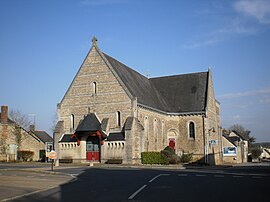
Louisfert
Louisfert | |
|---|---|
Commune | |
 | |
 Coat of arms | |
show Location of Louisfert | |
 Louisfert | |
| Coordinates: 47°40′33″N 1°25′54″W / 47.6758°N 1.4317°WCoordinates: 47°40′33″N 1°25′54″W / 47.6758°N 1.4317°W | |
| Country | France |
| Region | Pays de la Loire |
| Department | Loire-Atlantique |
| Arrondissement | Châteaubriant-Ancenis |
| Canton | Châteaubriant |
| Intercommunality | Châteaubriant-Derval |
| Government | |
| • Mayor (2020–2026) | Alain Guillois |
| Area 1 | 18.16 km2 (7.01 sq mi) |
| Population (Jan. 2018)[1] | 1,008 |
| • Density | 56/km2 (140/sq mi) |
| Time zone | UTC+01:00 (CET) |
| • Summer (DST) | UTC+02:00 (CEST) |
| INSEE/Postal code | 44085 /44110 |
| Elevation | 39–87 m (128–285 ft) |
| 1 French Land Register data, which excludes lakes, ponds, glaciers > 1 km2 (0.386 sq mi or 247 acres) and river estuaries. | |


Louisfert is a commune in the Loire-Atlantique department in western France.
Population[]
|
|
See also[]
- Communes of the Loire-Atlantique department
- The works of Jean Fréour Sculptor for Louisfert oratory.
References[]
- ^ "Populations légales 2018". INSEE. 28 December 2020.
| Wikimedia Commons has media related to Louisfert. |
| show Authority control |
|---|
This Loire-Atlantique geographical article is a stub. You can help Wikipedia by . |
Categories:
- Communes of Loire-Atlantique
- Loire-Atlantique geography stubs