Donges
Donges | |
|---|---|
Commune | |
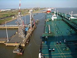 Oil tanker in the port | |
 Coat of arms | |
show Location of Donges | |
 Donges | |
| Coordinates: 47°19′27″N 2°04′30″W / 47.3242°N 2.075°WCoordinates: 47°19′27″N 2°04′30″W / 47.3242°N 2.075°W | |
| Country | France |
| Region | Pays de la Loire |
| Department | Loire-Atlantique |
| Arrondissement | Saint-Nazaire |
| Canton | Saint-Nazaire-2 |
| Intercommunality | CA Région Nazairienne et Estuaire |
| Government | |
| • Mayor (2020–2026) | François Chéneau |
| Area 1 | 59.9 km2 (23.1 sq mi) |
| Population (Jan. 2018)[1] | 8,038 |
| • Density | 130/km2 (350/sq mi) |
| Time zone | UTC+01:00 (CET) |
| • Summer (DST) | UTC+02:00 (CEST) |
| INSEE/Postal code | 44052 /44480 |
| Elevation | 0–31 m (0–102 ft) |
| 1 French Land Register data, which excludes lakes, ponds, glaciers > 1 km2 (0.386 sq mi or 247 acres) and river estuaries. | |


Donges (French pronunciation: [dɔ̃ʒ] (![]() listen); Breton: Donez) is a commune in the Loire-Atlantique department in the region of Pays de la Loire, France.
listen); Breton: Donez) is a commune in the Loire-Atlantique department in the region of Pays de la Loire, France.
Population[]
|
|
See also[]
- Communes of the Loire-Atlantique department
- Parc naturel régional de Brière
- André Bizette-Lindet
References[]
- ^ "Populations légales 2018". INSEE. 28 December 2020.
| Wikimedia Commons has media related to Donges. |
| show Authority control |
|---|
This Loire-Atlantique geographical article is a stub. You can help Wikipedia by . |
Categories:
- Communes of Loire-Atlantique
- Loire-Atlantique geography stubs