Fégréac
Fégréac | |
|---|---|
Commune | |
 | |
 Coat of arms | |
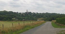
show Location of Fégréac | |
 Fégréac | |
| Coordinates: 47°35′08″N 2°02′36″W / 47.5856°N 2.0433°WCoordinates: 47°35′08″N 2°02′36″W / 47.5856°N 2.0433°W | |
| Country | France |
| Region | Pays de la Loire |
| Department | Loire-Atlantique |
| Arrondissement | Châteaubriant-Ancenis |
| Canton | Pontchâteau |
| Intercommunality | Redon Agglomération |
| Government | |
| • Mayor (2020–2026) | Jérome Ricordel |
| Area 1 | 44.18 km2 (17.06 sq mi) |
| Population (Jan. 2018)[1] | 2,395 |
| • Density | 54/km2 (140/sq mi) |
| Time zone | UTC+01:00 (CET) |
| • Summer (DST) | UTC+02:00 (CEST) |
| INSEE/Postal code | 44057 /44460 |
| Elevation | 0–62 m (0–203 ft) |
| 1 French Land Register data, which excludes lakes, ponds, glaciers > 1 km2 (0.386 sq mi or 247 acres) and river estuaries. | |


Fégréac (French pronunciation: [feɡʁeak] (![]() listen); Breton: Fegerieg) is a commune in the Loire-Atlantique department in western France.
listen); Breton: Fegerieg) is a commune in the Loire-Atlantique department in western France.
Population[]
| Year | Pop. | ±% |
|---|---|---|
| 1793 | 1,791 | — |
| 1806 | 1,526 | −14.8% |
| 1821 | 1,831 | +20.0% |
| 1831 | 2,272 | +24.1% |
| 1841 | 2,305 | +1.5% |
| 1851 | 2,470 | +7.2% |
| 1861 | 2,772 | +12.2% |
| 1872 | 2,871 | +3.6% |
| 1881 | 3,071 | +7.0% |
| 1891 | 3,073 | +0.1% |
| 1901 | 2,918 | −5.0% |
| 1911 | 2,762 | −5.3% |
| 1921 | 2,367 | −14.3% |
| 1931 | 2,239 | −5.4% |
| 1946 | 2,002 | −10.6% |
| 1954 | 2,006 | +0.2% |
| 1962 | 1,890 | −5.8% |
| 1968 | 1,835 | −2.9% |
| 1975 | 1,714 | −6.6% |
| 1982 | 1,752 | +2.2% |
| 1990 | 1,874 | +7.0% |
| 1999 | 1,994 | +6.4% |
| 2010 | 2,278 | +14.2% |
| 2017 | 2,445 | +7.3% |
See also[]
- Communes of the Loire-Atlantique department
References[]
- ^ "Populations légales 2018". INSEE. 28 December 2020.
| Wikimedia Commons has media related to Fégréac. |
This Loire-Atlantique geographical article is a stub. You can help Wikipedia by . |
Categories:
- Communes of Loire-Atlantique
- Loire-Atlantique geography stubs