Brouennes
Brouennes | |
|---|---|
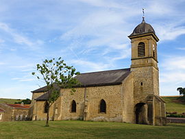 The church in Brouennes | |
show Location of Brouennes | |
 Brouennes | |
| Coordinates: 49°31′05″N 5°15′36″E / 49.5181°N 5.26°ECoordinates: 49°31′05″N 5°15′36″E / 49.5181°N 5.26°E | |
| Country | France |
| Region | Grand Est |
| Department | Meuse |
| Arrondissement | Verdun |
| Canton | Stenay |
| Intercommunality | CC du Pays de Stenay et du Val Dunois |
| Government | |
| • Mayor (2020–2026) | Bernard Kazuk |
| Area 1 | 12.22 km2 (4.72 sq mi) |
| Population (Jan. 2018)[1] | 151 |
| • Density | 12/km2 (32/sq mi) |
| Time zone | UTC+01:00 (CET) |
| • Summer (DST) | UTC+02:00 (CEST) |
| INSEE/Postal code | 55083 /55700 |
| Elevation | 167–296 m (548–971 ft) (avg. 200 m or 660 ft) |
| 1 French Land Register data, which excludes lakes, ponds, glaciers > 1 km2 (0.386 sq mi or 247 acres) and river estuaries. | |


Brouennes (French pronunciation: [bʁu.ɛn]) is a commune in the Meuse department in Grand Est in northeastern France.
Population[]
| Year | Pop. | ±% |
|---|---|---|
| 1962 | 165 | — |
| 1968 | 167 | +1.2% |
| 1975 | 155 | −7.2% |
| 1982 | 148 | −4.5% |
| 1990 | 160 | +8.1% |
| 1999 | 145 | −9.4% |
| 2009 | 158 | +9.0% |
See also[]
References[]
- ^ "Populations légales 2018". INSEE. 28 December 2020.
| Wikimedia Commons has media related to Brouennes. |
This Meuse geographical article is a stub. You can help Wikipedia by . |
Categories:
- Communes of Meuse (department)
- Meuse (department) geography stubs