Rupt-en-Woëvre
Rupt-en-Woëvre | |
|---|---|
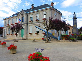 The town hall in Rupt-en-Woëvre | |
show Location of Rupt-en-Woëvre | |
 Rupt-en-Woëvre | |
| Coordinates: 49°03′11″N 5°29′20″E / 49.0531°N 5.4889°ECoordinates: 49°03′11″N 5°29′20″E / 49.0531°N 5.4889°E | |
| Country | France |
| Region | Grand Est |
| Department | Meuse |
| Arrondissement | Verdun |
| Canton | Dieue-sur-Meuse |
| Government | |
| • Mayor (2020–2026) | Marc Champlon |
| Area 1 | 17.05 km2 (6.58 sq mi) |
| Population (Jan. 2018)[1] | 294 |
| • Density | 17/km2 (45/sq mi) |
| Time zone | UTC+01:00 (CET) |
| • Summer (DST) | UTC+02:00 (CEST) |
| INSEE/Postal code | 55449 /55320 |
| Elevation | 228–393 m (748–1,289 ft) (avg. 245 m or 804 ft) |
| 1 French Land Register data, which excludes lakes, ponds, glaciers > 1 km2 (0.386 sq mi or 247 acres) and river estuaries. | |


Rupt-en-Woëvre (French pronunciation: [ʁy ɑ̃ wavʁ], literally Rupt in Woëvre) is a commune in the Meuse department in Grand Est in north-eastern France.
See also[]
References[]
- ^ "Populations légales 2018". INSEE. 28 December 2020.
| Wikimedia Commons has media related to Rupt-en-Woëvre. |
This Meuse geographical article is a stub. You can help Wikipedia by . |
Categories:
- Communes of Meuse (department)
- Meuse (department) geography stubs