Ménil-sur-Saulx
Ménil-sur-Saulx | |
|---|---|
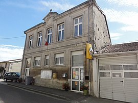 The town hall in Ménil-sur-Saulx | |
 Coat of arms | |
show Location of Ménil-sur-Saulx | |
 Ménil-sur-Saulx | |
| Coordinates: 48°37′42″N 5°13′04″E / 48.6283°N 5.2178°ECoordinates: 48°37′42″N 5°13′04″E / 48.6283°N 5.2178°E | |
| Country | France |
| Region | Grand Est |
| Department | Meuse |
| Arrondissement | Bar-le-Duc |
| Canton | Ligny-en-Barrois |
| Intercommunality | CC Portes de Meuse |
| Government | |
| • Mayor (2020–2026) | Thierry Vigneau Boiserie |
| Area 1 | 12.03 km2 (4.64 sq mi) |
| Population (Jan. 2018)[1] | 254 |
| • Density | 21/km2 (55/sq mi) |
| Time zone | UTC+01:00 (CET) |
| • Summer (DST) | UTC+02:00 (CEST) |
| INSEE/Postal code | 55335 /55500 |
| Elevation | 214–291 m (702–955 ft) (avg. 238 m or 781 ft) |
| 1 French Land Register data, which excludes lakes, ponds, glaciers > 1 km2 (0.386 sq mi or 247 acres) and river estuaries. | |


Ménil-sur-Saulx (French pronunciation: [menil syʁ so], literally Ménil on Saulx) is a commune in the Meuse department in Grand Est in north-eastern France.
Geography[]
The river Saulx flows northwestward through the commune and crosses the village.
See also[]
References[]
- ^ "Populations légales 2018". INSEE. 28 December 2020.
| Wikimedia Commons has media related to Ménil-sur-Saulx. |
This Meuse geographical article is a stub. You can help Wikipedia by . |
Categories:
- Communes of Meuse (department)
- Meuse (department) geography stubs