Saint-André-en-Barrois
Saint-André-en-Barrois | |
|---|---|
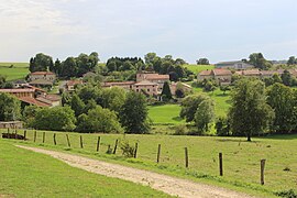 A general view Saint-André-en-Barrois | |
 Coat of arms | |
show Location of Saint-André-en-Barrois | |
 Saint-André-en-Barrois | |
| Coordinates: 49°00′51″N 5°13′51″E / 49.0142°N 5.2308°ECoordinates: 49°00′51″N 5°13′51″E / 49.0142°N 5.2308°E | |
| Country | France |
| Region | Grand Est |
| Department | Meuse |
| Arrondissement | Verdun |
| Canton | Dieue-sur-Meuse |
| Intercommunality | Val de Meuse - Voie Sacrée |
| Government | |
| • Mayor (2008–2014) | Raoul Valroff |
| Area 1 | 9.33 km2 (3.60 sq mi) |
| Population (Jan. 2018)[1] | 66 |
| • Density | 7.1/km2 (18/sq mi) |
| Time zone | UTC+01:00 (CET) |
| • Summer (DST) | UTC+02:00 (CEST) |
| INSEE/Postal code | 55453 /55220 |
| Elevation | 241–326 m (791–1,070 ft) (avg. 265 m or 869 ft) |
| 1 French Land Register data, which excludes lakes, ponds, glaciers > 1 km2 (0.386 sq mi or 247 acres) and river estuaries. | |


Saint-André-en-Barrois is a commune in the Meuse department in Grand Est in north-eastern France.
See also[]
References[]
- ^ "Populations légales 2018". INSEE. 28 December 2020.
| Wikimedia Commons has media related to Saint-André-en-Barrois. |
This Meuse geographical article is a stub. You can help Wikipedia by . |
Categories:
- Communes of Meuse (department)
- Meuse (department) geography stubs