Han-lès-Juvigny
From Wikipedia, the free encyclopedia
Commune in Grand Est, France
Han-lès-Juvigny | |
|---|---|
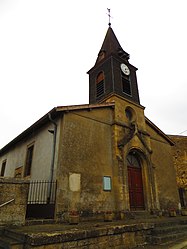 The church in Han-lès-Juvigny | |
Location of Han-lès-Juvigny  | |
 Han-lès-Juvigny  Han-lès-Juvigny | |
Coordinates:  49°28′54″N 5°19′59″E / 49.4817°N 5.3331°E / 49.4817; 5.3331Coordinates: 49°28′54″N 5°19′59″E / 49.4817°N 5.3331°E / 49.4817; 5.3331 49°28′54″N 5°19′59″E / 49.4817°N 5.3331°E / 49.4817; 5.3331Coordinates: 49°28′54″N 5°19′59″E / 49.4817°N 5.3331°E / 49.4817; 5.3331 | |
| Country | France |
| Region | Grand Est |
| Department | Meuse |
| Arrondissement | Verdun |
| Canton | Montmédy |
| Intercommunality | |
| Government | |
| • Mayor (2020–2026) | Christian Saunois |
| Area 1 | 5.44 km2 (2.10 sq mi) |
| Population (Jan. 2018)[1] | 122 |
| • Density | 22/km2 (58/sq mi) |
| Time zone | UTC+01:00 (CET) |
| • Summer (DST) | UTC+02:00 (CEST) |
| INSEE/Postal code | 55226 /55600 |
| Elevation | 177–308 m (581–1,010 ft) (avg. 310 m or 1,020 ft) |
| 1 French Land Register data, which excludes lakes, ponds, glaciers > 1 km2 (0.386 sq mi or 247 acres) and river estuaries. | |
Han-lès-Juvigny (French pronunciation: [ɑ̃ lɛ ʒyviɲi]) is a commune in the Meuse department in Grand Est in north-eastern France.
See also[]
References[]
- ^ "Populations légales 2018". The National Institute of Statistics and Economic Studies. 28 December 2020.
| Wikimedia Commons has media related to Han-lès-Juvigny. |
This Meuse geographical article is a stub. You can help Wikipedia by . |
- v
- t
Retrieved from ""
Categories:
- Communes of Meuse (department)
- Meuse (department) geography stubs
Hidden categories:
- Articles with short description
- Short description is different from Wikidata
- Infobox mapframe without OSM relation ID on Wikidata
- Coordinates on Wikidata
- Pages using infobox settlement with image map1 but not image map
- Commons category link from Wikidata
- AC with 0 elements
- All stub articles
- Pages using the Kartographer extension