Nixéville-Blercourt
Nixéville-Blercourt | |
|---|---|
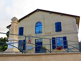 The town hall in Nixéville-Blercourt | |
show Location of Nixéville-Blercourt | |
 Nixéville-Blercourt | |
| Coordinates: 49°06′38″N 5°16′32″E / 49.1106°N 5.2756°ECoordinates: 49°06′38″N 5°16′32″E / 49.1106°N 5.2756°E | |
| Country | France |
| Region | Grand Est |
| Department | Meuse |
| Arrondissement | Verdun |
| Canton | Dieue-sur-Meuse |
| Intercommunality | Val de Meuse - Voie Sacrée |
| Government | |
| • Mayor (2008–2014) | Gilles Vautrin |
| Area 1 | 19.54 km2 (7.54 sq mi) |
| Population (Jan. 2018)[1] | 496 |
| • Density | 25/km2 (66/sq mi) |
| Time zone | UTC+01:00 (CET) |
| • Summer (DST) | UTC+02:00 (CEST) |
| INSEE/Postal code | 55385 /55120 |
| Elevation | 220–347 m (722–1,138 ft) (avg. 271 m or 889 ft) |
| 1 French Land Register data, which excludes lakes, ponds, glaciers > 1 km2 (0.386 sq mi or 247 acres) and river estuaries. | |


Nixéville-Blercourt is a commune in the Meuse department in Grand Est in north-eastern France.
See also[]
References[]
- ^ "Populations légales 2018". INSEE. 28 December 2020.
| Wikimedia Commons has media related to Nixéville-Blercourt. |
This Meuse geographical article is a stub. You can help Wikipedia by . |
Categories:
- Communes of Meuse (department)
- Meuse (department) geography stubs