Rouvrois-sur-Othain
Rouvrois-sur-Othain | |
|---|---|
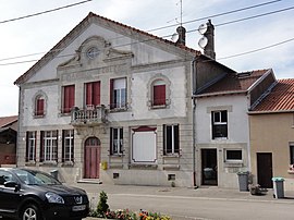 The town hall in Rouvrois-sur-Othain | |
 Coat of arms | |
show Location of Rouvrois-sur-Othain | |
 Rouvrois-sur-Othain | |
| Coordinates: 49°22′46″N 5°37′47″E / 49.3794°N 5.6297°ECoordinates: 49°22′46″N 5°37′47″E / 49.3794°N 5.6297°E | |
| Country | France |
| Region | Grand Est |
| Department | Meuse |
| Arrondissement | Verdun |
| Canton | Bouligny |
| Intercommunality | CC Damvillers Spincourt |
| Government | |
| • Mayor (2020–2026) | Denis Pierre |
| Area 1 | 12.56 km2 (4.85 sq mi) |
| Population (Jan. 2018)[1] | 192 |
| • Density | 15/km2 (40/sq mi) |
| Time zone | UTC+01:00 (CET) |
| • Summer (DST) | UTC+02:00 (CEST) |
| INSEE/Postal code | 55445 /55230 |
| 1 French Land Register data, which excludes lakes, ponds, glaciers > 1 km2 (0.386 sq mi or 247 acres) and river estuaries. | |


Rouvrois-sur-Othain (French pronunciation: [ʁuvʁwa syʁ ɔtɛ̃], literally Rouvrois on Othain) is a commune in the Meuse department in Grand Est in north-eastern France.
Geography[]
The river Othain forms all of the commune's south-western border.
See also[]
References[]
- ^ "Populations légales 2018". INSEE. 28 December 2020.
| Wikimedia Commons has media related to Rouvrois-sur-Othain. |
This Meuse geographical article is a stub. You can help Wikipedia by . |
Categories:
- Communes of Meuse (department)
- Meuse (department) geography stubs