Varnéville
Varnéville | |
|---|---|
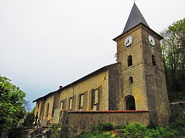 The church in Varnéville | |
 Coat of arms | |
show Location of Varnéville | |
 Varnéville | |
| Coordinates: 48°52′21″N 5°39′22″E / 48.8725°N 5.6561°ECoordinates: 48°52′21″N 5°39′22″E / 48.8725°N 5.6561°E | |
| Country | France |
| Region | Grand Est |
| Department | Meuse |
| Arrondissement | Commercy |
| Canton | Saint-Mihiel |
| Intercommunality | CC Côtes de Meuse Woëvre |
| Government | |
| • Mayor (2020–2026) | Bernard Reuter |
| Area 1 | 6.44 km2 (2.49 sq mi) |
| Population (Jan. 2018)[1] | 53 |
| • Density | 8.2/km2 (21/sq mi) |
| Time zone | UTC+01:00 (CET) |
| • Summer (DST) | UTC+02:00 (CEST) |
| INSEE/Postal code | 55528 /55300 |
| Elevation | 235–382 m (771–1,253 ft) (avg. 270 m or 890 ft) |
| 1 French Land Register data, which excludes lakes, ponds, glaciers > 1 km2 (0.386 sq mi or 247 acres) and river estuaries. | |


Varnéville (French pronunciation: [vaʁnevil]) is a commune in the Meuse department in Grand Est in north-eastern France.
See also[]
References[]
- ^ "Populations légales 2018". INSEE. 28 December 2020.
External links[]
| Wikimedia Commons has media related to Varnéville. |
This Meuse geographical article is a stub. You can help Wikipedia by . |
Categories:
- Communes of Meuse (department)
- Meuse (department) geography stubs