Laheycourt
Laheycourt | |
|---|---|
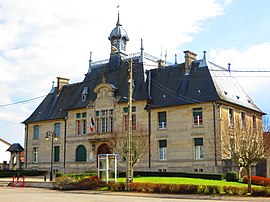 The town hall in Laheycourt | |
 Coat of arms | |
show Location of Laheycourt | |
 Laheycourt | |
| Coordinates: 48°53′30″N 5°01′25″E / 48.8917°N 5.0236°ECoordinates: 48°53′30″N 5°01′25″E / 48.8917°N 5.0236°E | |
| Country | France |
| Region | Grand Est |
| Department | Meuse |
| Arrondissement | Bar-le-Duc |
| Canton | Revigny-sur-Ornain |
| Intercommunality | |
| Government | |
| • Mayor (2020–2026) | Jean-Jacques Westrich |
| Area 1 | 18 km2 (7 sq mi) |
| Population (Jan. 2018)[1] | 392 |
| • Density | 22/km2 (56/sq mi) |
| Time zone | UTC+01:00 (CET) |
| • Summer (DST) | UTC+02:00 (CEST) |
| INSEE/Postal code | 55271 /55800 |
| Elevation | 156–204 m (512–669 ft) (avg. 170 m or 560 ft) |
| 1 French Land Register data, which excludes lakes, ponds, glaciers > 1 km2 (0.386 sq mi or 247 acres) and river estuaries. | |


Laheycourt (French pronunciation: [la.ekuʁ]) is a commune in the Meuse department in Grand Est in north-eastern France.
Geography[]
The Chée flows westward through the southern part of the commune and crosses the village.
See also[]
References[]
- ^ "Populations légales 2018". INSEE. 28 December 2020.
| Wikimedia Commons has media related to Laheycourt. |
This Meuse geographical article is a stub. You can help Wikipedia by . |
Categories:
- Communes of Meuse (department)
- Meuse (department) geography stubs