Champneuville
Champneuville | |
|---|---|
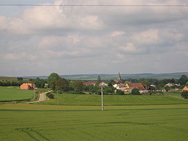 A general view of Champneuville | |
 Coat of arms | |
show Location of Champneuville | |
 Champneuville | |
| Coordinates: 49°14′15″N 5°19′38″E / 49.2375°N 5.3272°ECoordinates: 49°14′15″N 5°19′38″E / 49.2375°N 5.3272°E | |
| Country | France |
| Region | Grand Est |
| Department | Meuse |
| Arrondissement | Verdun |
| Canton | Belleville-sur-Meuse |
| Intercommunality | Grand Verdun |
| Government | |
| • Mayor (2020–2026) | Fabrice Beaumet |
| Area 1 | 11.99 km2 (4.63 sq mi) |
| Population (Jan. 2018)[1] | 119 |
| • Density | 9.9/km2 (26/sq mi) |
| Time zone | UTC+01:00 (CET) |
| • Summer (DST) | UTC+02:00 (CEST) |
| INSEE/Postal code | 55099 /55100 |
| Elevation | 181–337 m (594–1,106 ft) (avg. 235 m or 771 ft) |
| 1 French Land Register data, which excludes lakes, ponds, glaciers > 1 km2 (0.386 sq mi or 247 acres) and river estuaries. | |


Champneuville (French pronunciation: [ʃɑ̃nøvil]) is a commune in the Meuse department in Grand Est in north-eastern France.
See also[]
References[]
- ^ "Populations légales 2018". INSEE. 28 December 2020.
| Wikimedia Commons has media related to Champneuville. |
This Meuse geographical article is a stub. You can help Wikipedia by . |
Categories:
- Communes of Meuse (department)
- Meuse (department) geography stubs