Chauvency-le-Château
Chauvency-le-Château | |
|---|---|
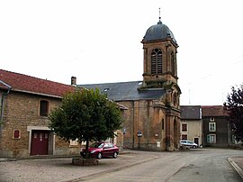 The church in Chauvency-le-Château | |
show Location of Chauvency-le-Château | |
 Chauvency-le-Château | |
| Coordinates: 49°31′11″N 5°18′38″E / 49.5197°N 5.3106°ECoordinates: 49°31′11″N 5°18′38″E / 49.5197°N 5.3106°E | |
| Country | France |
| Region | Grand Est |
| Department | Meuse |
| Arrondissement | Verdun |
| Canton | Montmédy |
| Intercommunality | |
| Government | |
| • Mayor (2020–2026) | Daniel Regnauld |
| Area 1 | 8.82 km2 (3.41 sq mi) |
| Population (Jan. 2018)[1] | 242 |
| • Density | 27/km2 (71/sq mi) |
| Time zone | UTC+01:00 (CET) |
| • Summer (DST) | UTC+02:00 (CEST) |
| INSEE/Postal code | 55109 /55600 |
| Elevation | 172–327 m (564–1,073 ft) (avg. 181 m or 594 ft) |
| 1 French Land Register data, which excludes lakes, ponds, glaciers > 1 km2 (0.386 sq mi or 247 acres) and river estuaries. | |


Chauvency-le-Château
Chauvency-le-Château (French pronunciation: [ʃovɑ̃si l(ə) ʃɑto]) is a commune in the Meuse department in Grand Est in north-eastern France.
The Chauvency tournament took place in 1285. The story of the tournament has been told by trouvère Jacques Bretel, and is kept in a manuscript (reference: Douce 308) at the Bodleian Library.
See also[]
References[]
- ^ "Populations légales 2018". INSEE. 28 December 2020.
| Wikimedia Commons has media related to Chauvency-le-Château. |
This Meuse geographical article is a stub. You can help Wikipedia by . |
Categories:
- Communes of Meuse (department)
- Meuse (department) geography stubs