Watronville
Watronville | |
|---|---|
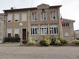 The town hall in Watronville | |
show Location of Watronville | |
 Watronville | |
| Coordinates: 49°08′16″N 5°32′33″E / 49.1378°N 5.5425°ECoordinates: 49°08′16″N 5°32′33″E / 49.1378°N 5.5425°E | |
| Country | France |
| Region | Grand Est |
| Department | Meuse |
| Arrondissement | Verdun |
| Canton | Étain |
| Intercommunality | |
| Government | |
| • Mayor (2014-2020) | Dominique Roy |
| Area 1 | 6.39 km2 (2.47 sq mi) |
| Population (Jan. 2018)[1] | 103 |
| • Density | 16/km2 (42/sq mi) |
| Time zone | UTC+01:00 (CET) |
| • Summer (DST) | UTC+02:00 (CEST) |
| INSEE/Postal code | 55579 /55160 |
| Elevation | 215–363 m (705–1,191 ft) (avg. 257 m or 843 ft) |
| 1 French Land Register data, which excludes lakes, ponds, glaciers > 1 km2 (0.386 sq mi or 247 acres) and river estuaries. | |


Watronville is a commune in the Meuse department in Grand Est in north-eastern France.
Population[]
| Year | Pop. | ±% |
|---|---|---|
| 2006 | 107 | — |
| 2007 | 107 | +0.0% |
| 2008 | 107 | +0.0% |
| 2009 | 106 | −0.9% |
| 2010 | 109 | +2.8% |
| 2011 | 110 | +0.9% |
| 2012 | 112 | +1.8% |
| 2013 | 114 | +1.8% |
| 2014 | 113 | −0.9% |
| 2015 | 111 | −1.8% |
| 2016 | 108 | −2.7% |
See also[]
References[]
- ^ "Populations légales 2018". INSEE. 28 December 2020.
| Wikimedia Commons has media related to Watronville. |
This Meuse geographical article is a stub. You can help Wikipedia by . |
Categories:
- Communes of Meuse (department)
- Meuse (department) geography stubs