Conques-en-Rouergue
Conques-en-Rouergue | |
|---|---|
 | |
show Location of Conques-en-Rouergue | |
 Conques-en-Rouergue | |
| Coordinates: 44°35′56″N 2°23′53″E / 44.599°N 2.398°ECoordinates: 44°35′56″N 2°23′53″E / 44.599°N 2.398°E | |
| Country | France |
| Region | Occitanie |
| Department | Aveyron |
| Arrondissement | Rodez |
| Canton | Lot et Dourdou |
| Government | |
| • Mayor (2020–2026) | Bernard Lefebvre |
| Area 1 | 106.23 km2 (41.02 sq mi) |
| Population (Jan. 2018)[1] | 1,643 |
| • Density | 15/km2 (40/sq mi) |
| Time zone | UTC+01:00 (CET) |
| • Summer (DST) | UTC+02:00 (CEST) |
| INSEE/Postal code | 12076 /12320 |
| 1 French Land Register data, which excludes lakes, ponds, glaciers > 1 km2 (0.386 sq mi or 247 acres) and river estuaries. | |


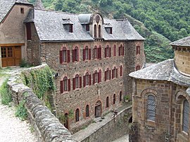
Conques-en-Rouergue (French pronunciation: [kɔ̃k ɑ̃ ʁwɛʁɡ], literally Conques in Rouergue; Occitan: Concas de Roergue) is a commune in the department of Aveyron, southern France. It lies on the Lot river. The municipality was established on 1 January 2016 by merger of the former communes of Conques, Grand-Vabre, Noailhac and Saint-Cyprien-sur-Dourdou.[2]
Further reading[]
- Parayre, Henry (1951). Conques-en-Rouergue... son église, son trésor. Toulouse: Imprimerie du Sud-Ouest. OCLC 465841464.
References[]
- ^ "Populations légales 2018". INSEE. 28 December 2020.
- ^ Arrêté préfectoral 19 November 2015 (in French)
See also[]
| show Authority control |
|---|
This Aveyron geographical article is a stub. You can help Wikipedia by . |
Categories:
- Communes of Aveyron
- Populated places established in 2016
- Aveyron geography stubs