Conteville, Seine-Maritime
Conteville | |
|---|---|
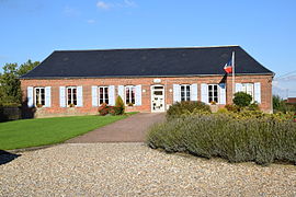 The town hall in Conteville | |
show Location of Conteville | |
 Conteville | |
| Coordinates: 49°41′42″N 1°38′06″E / 49.695°N 1.635°ECoordinates: 49°41′42″N 1°38′06″E / 49.695°N 1.635°E | |
| Country | France |
| Region | Normandy |
| Department | Seine-Maritime |
| Arrondissement | Dieppe |
| Canton | Gournay-en-Bray |
| Intercommunality | CC Aumale - Blangy-sur-Bresle |
| Government | |
| • Mayor (2020–2026) | Jean-Pierre Courtois[1] |
| Area 1 | 13.71 km2 (5.29 sq mi) |
| Population (Jan. 2018)[2] | 496 |
| • Density | 36/km2 (94/sq mi) |
| Time zone | UTC+01:00 (CET) |
| • Summer (DST) | UTC+02:00 (CEST) |
| INSEE/Postal code | 76186 /76390 |
| Elevation | 193–247 m (633–810 ft) (avg. 248 m or 814 ft) |
| 1 French Land Register data, which excludes lakes, ponds, glaciers > 1 km2 (0.386 sq mi or 247 acres) and river estuaries. | |


Conteville is a commune in the Seine-Maritime department in the Normandy region in northern France.
Geography[]
A farming village situated in the Pays de Bray, some 36 miles (58 km) southeast of Dieppe, at the junction of the D9 and the D36 roads.
Population[]
| Year | 1962 | 1968 | 1975 | 1982 | 1990 | 1999 | 2006 |
|---|---|---|---|---|---|---|---|
| Population | 465 | 504 | 447 | 401 | 460 | 454 | 477 |
| From the year 1962 on: No double counting—residents of multiple communes (e.g. students and military personnel) are counted only once. | |||||||
Places of interest[]
- The church of St.Nicolas, dating from the eighteenth century.
See also[]
- Communes of the Seine-Maritime department
References[]
- ^ "Répertoire national des élus: les maires". data.gouv.fr, Plateforme ouverte des données publiques françaises (in French). 2 December 2020.
- ^ "Populations légales 2018". INSEE. 28 December 2020.
| Wikimedia Commons has media related to Conteville (Seine-Maritime). |
| show Communes of the Seine-Maritime department |
|---|
Categories:
- Communes of Seine-Maritime
- Dieppe geography stubs