Gölköy
Gölköy | |
|---|---|
District | |
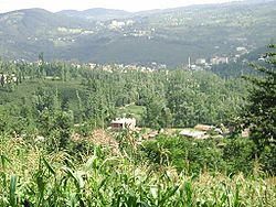 A panoramic view of Gölköy | |
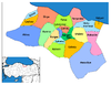
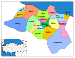 Location of Gölköy within Turkey. | |
 Gölköy Location of Gölköy | |
| Coordinates: 40°41′N 37°37′E / 40.683°N 37.617°E | |
| Country | |
| Region | Black Sea |
| Province | Ordu |
| Government | |
| • Mayor | Ali Kemal Mert (AKP) |
| Area | |
| • District | 414.77 km2 (160.14 sq mi) |
| Elevation | 1,054 m (3,458 ft) |
| Population (2012)[2] | |
| • Urban | 12,822 |
| • District | 37,564 |
| • District density | 91/km2 (230/sq mi) |
| Time zone | UTC+2 (EET) |
| • Summer (DST) | UTC+3 (EEST) |
| Postal code | 52600 |
| Area code(s) | 0452 |
| Licence plate | 52 |
| Climate | Csb |
| Website | www.golkoy.bel.tr |

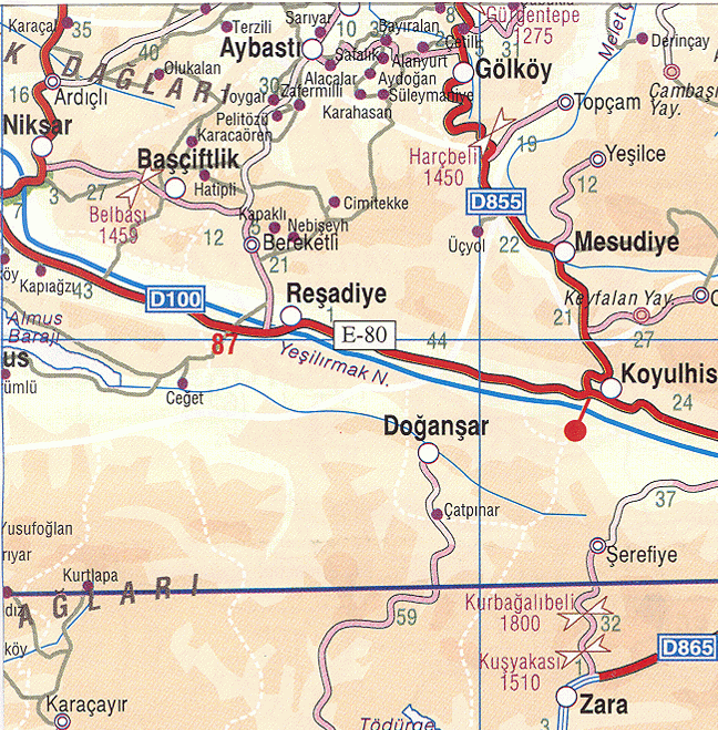
Gölköy is a town and district of Ordu Province in the Black Sea region of Turkey. The town is located 60 km (37 mi) inland from the city of Ordu on the road to Sivas. According to the 2000 census, population of the district is 66,491 of which 24,162 live in the town of Gölköy.[3][4] The district covers an area of 415 km2 (160 sq mi),[5] and the town lies at an elevation of 1,054 m (3,458 ft).
Places of interest include the Byzantine castle of Habsamana, and a number of places for walking and climbing including the village of and the lake of .[citation needed]
The villages of Gölköy district include Ahmetli, Akçalı, Bayıralan, Bulut, Cihadiye, Çatak, Çetilli, Emirler, Güzelyayla, Haruniye, Hürriyet, İçyaka, Kaleköy, Konak, Kozören, Özlü, Süleymaniye, and Yuvapınar.
Gallery[]
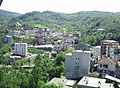
Gölköy town center

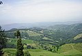
A small lake in Gölköy district
Cihadiye, a village in Gölköy district


Notes[]
- ^ "Area of regions (including lakes), km²". Regional Statistics Database. Turkish Statistical Institute. 2002. Retrieved 2013-03-05.
- ^ "Population of province/district centers and towns/villages by districts - 2012". Address Based Population Registration System (ABPRS) Database. Turkish Statistical Institute. Retrieved 2013-02-27.
- ^ Turkish Statistical Institute. "Census 2000, Key statistics for urban areas of Turkey" (XLS) (in Turkish). Retrieved 2009-05-18.
- ^ GeoHive. "Statistical information on Turkey's administrative units". Retrieved 2009-05-18.
- ^ Statoids. "Statistical information on districts of Turkey". Retrieved 2009-05-18.
References[]
- Falling Rain Genomics, Inc. "Geographical information on Gölköy, Turkey". Retrieved 2009-05-18.
External links[]
![]() Media related to Gölköy, Ordu at Wikimedia Commons
Media related to Gölköy, Ordu at Wikimedia Commons
- District governor's official website (in Turkish)
- District municipality's official website (in Turkish)
- Road map of Gölköy and environs
- Detailed road map of Gölköy district
- Various images of Gölköy, Ordu
| show Gölköy in Ordu Province of Turkey |
|---|
Coordinates: 40°41′15″N 37°37′04″E / 40.68750°N 37.61778°E
This article about a Black Sea Region of Turkey location is a stub. You can help Wikipedia by . |
- Populated places in Ordu Province
- Districts of Ordu Province
- Black Sea Region geography stubs