Graimbouville
Graimbouville | |
|---|---|
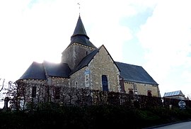 The church in Graimbouville | |
show Location of Graimbouville | |
 Graimbouville | |
| Coordinates: 49°34′25″N 0°19′48″E / 49.5736°N 0.33°ECoordinates: 49°34′25″N 0°19′48″E / 49.5736°N 0.33°E | |
| Country | France |
| Region | Normandy |
| Department | Seine-Maritime |
| Arrondissement | Le Havre |
| Canton | Saint-Romain-de-Colbosc |
| Intercommunality | Le Havre Seine Métropole |
| Government | |
| • Mayor (2020–2026) | Sylvain Vasse[1] |
| Area 1 | 6.4 km2 (2.5 sq mi) |
| Population (Jan. 2018)[2] | 614 |
| • Density | 96/km2 (250/sq mi) |
| Time zone | UTC+01:00 (CET) |
| • Summer (DST) | UTC+02:00 (CEST) |
| INSEE/Postal code | 76314 /76430 |
| Elevation | 98–127 m (322–417 ft) (avg. 101 m or 331 ft) |
| 1 French Land Register data, which excludes lakes, ponds, glaciers > 1 km2 (0.386 sq mi or 247 acres) and river estuaries. | |


Graimbouville is a commune in the Seine-Maritime department in the Normandy region in northern France.
Geography[]
A farming village situated in the Pays de Caux, some 13 miles (21 km) northeast of Le Havre, at the junction of the D234 and D434 roads. The A29 autoroute passes through the southern tip of the commune.
Population[]
| Year | 1962 | 1968 | 1975 | 1982 | 1990 | 1999 | 2006 |
|---|---|---|---|---|---|---|---|
| Population | 258 | 315 | 390 | 375 | 409 | 496 | 574 |
| From the year 1962 on: No double counting—residents of multiple communes (e.g. students and military personnel) are counted only once. | |||||||
Places of interest[]
- The church of St. Pierre & St.Paul, dating from the eleventh century.
- The motte of a 12th-century castle.
- The sixteenth century chateau de Goutimesnil.
See also[]
- Communes of the Seine-Maritime department
References[]
- ^ "Répertoire national des élus: les maires". data.gouv.fr, Plateforme ouverte des données publiques françaises (in French). 2 December 2020. Retrieved 7 December 2020.
- ^ "Populations légales 2018". INSEE. 28 December 2020.
| Wikimedia Commons has media related to Graimbouville. |
| show Communes of the Seine-Maritime department |
|---|
Categories:
- Communes of Seine-Maritime
- Le Havre geography stubs