La Vieux-Rue
La Vieux-Rue | |
|---|---|
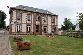 The town hall in La Vieux-Rue | |
show Location of La Vieux-Rue | |
 La Vieux-Rue | |
| Coordinates: 49°29′37″N 1°14′57″E / 49.4936°N 1.2492°ECoordinates: 49°29′37″N 1°14′57″E / 49.4936°N 1.2492°E | |
| Country | France |
| Region | Normandy |
| Department | Seine-Maritime |
| Arrondissement | Rouen |
| Canton | Le Mesnil-Esnard |
| Government | |
| • Mayor (2020–2026) | Thierry Vanderpert[1] |
| Area 1 | 5.51 km2 (2.13 sq mi) |
| Population (Jan. 2018)[2] | 572 |
| • Density | 100/km2 (270/sq mi) |
| Time zone | UTC+01:00 (CET) |
| • Summer (DST) | UTC+02:00 (CEST) |
| INSEE/Postal code | 76740 /76160 |
| Elevation | 124–176 m (407–577 ft) (avg. 164 m or 538 ft) |
| 1 French Land Register data, which excludes lakes, ponds, glaciers > 1 km2 (0.386 sq mi or 247 acres) and river estuaries. | |


La Vieux-Rue is a commune in the Seine-Maritime department in the Normandy region in northern France.
Geography[]
La Vieux-Rue is a farming village situated some 9 miles (14 km) northeast of Rouen, at the junction of the D15 and the D61 roads.
Population[]
| Year | 1962 | 1968 | 1975 | 1982 | 1990 | 1999 | 2006 |
|---|---|---|---|---|---|---|---|
| Population | 168 | 196 | 249 | 311 | 374 | 407 | 448 |
| From the year 1962 on: No double counting—residents of multiple communes (e.g. students and military personnel) are counted only once. | |||||||
Places of interest[]
- The church of St. Martin, dating from the thirteenth century.
- The chateau, dating from the seventeenth century.
- The sixteenth-century manorhouse of Saint-Saire.
See also[]
- Communes of the Seine-Maritime department
References[]
- ^ Liste des maires du département de la Seine-Maritime, 10 August 2020
- ^ "Populations légales 2018". INSEE. 28 December 2020.
External links[]
| Wikimedia Commons has media related to La Vieux-Rue. |
- Website of the Mairie (in French)
- Website of a local association (in French)
| show Communes of the Seine-Maritime department |
|---|
Categories:
- Communes of Seine-Maritime
- Rouen geography stubs