McNairy County, Tennessee
McNairy County | |
|---|---|
U.S. county | |
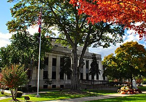 McNairy County Courthouse in Selmer | |
 Location within the U.S. state of Tennessee | |
 Tennessee's location within the U.S. | |
| Coordinates: 35°11′N 88°34′W / 35.18°N 88.56°W | |
| Country | |
| State | |
| Founded | October 8, 1823 |
| Named for | John McNairy[1] |
| Seat | Selmer |
| Largest town | Selmer |
| Area | |
| • Total | 564 sq mi (1,460 km2) |
| • Land | 563 sq mi (1,460 km2) |
| • Water | 0.8 sq mi (2 km2) 0.1%% |
| Population | |
| • Estimate (2018) | 25,823 |
| • Density | 46/sq mi (18/km2) |
| Time zone | UTC−6 (Central) |
| • Summer (DST) | UTC−5 (CDT) |
| Congressional district | 7th |
| Website | www |

McNairy County is a county located in the U.S. state of Tennessee. As of the 2010 census, the population was 26,075.[2] Its county seat is Selmer.[3] McNairy County is located along Tennessee's border with the state of Mississippi.
Sheriff Buford Pusser, whose story was told in the Walking Tall series of movies, was the sheriff of McNairy County from 1964 to 1970.[4]
McNairy County is the location of the Coon Creek Science Center, a notable fossil site that preserves Late Cretaceous marine shells and vertebrate remains (such as mosasaurs).
The postwar musical environment of the county played a pivotal role in the development of popular music. Influential disc jockey Dewey Phillips hailed from Adamsville, Tennessee. Carl Perkins made the first recordings of his career in the home studio of Stanton Littlejohn at Eastview, Tennessee.[5] Elvis Presley and Carl Perkins had their first meeting at one of Presley's earliest road performances in Bethel Springs, Tennessee.
History[]

McNairy County was formed in 1823 from parts of Hardin County, and was named for Judge John McNairy.[1]
County seat[]
Purdy was the county seat of McNairy County until 1890.[6] Since then, Selmer has been the county seat.
Sheriff Buford Pusser[]
Buford Pusser served as the sheriff of McNairy County from 1964 to 1970. The courthouse and jail in Selmer were his base of operations. He gained prominence for his fight against illegal distilleries, bootleggers, gambling establishments, and corruption in the county. His story has been made famous in the Walking Tall series of movies starring Joe Don Baker, Bo Svenson, Brian Dennehy, Dwayne Johnson, and in numerous documentaries and books.[4][7]
Newspapers[]
The oldest existing business in McNairy County is its newspaper, the Independent Appeal, which was founded in 1902.[citation needed] It is located in Selmer.
In 2009, Tom Evans, a former reporter and photographer for the Independent Appeal, formed his own weekly newspaper, The McNairy County News.
School District[]
- McNairy County Central High School
- Selmer Middle School
- Selmer Elementary School
- Adamsville High School
- Adamsville Elementary School
- Michie Elementary School
- Bethel Springs Elementary School
- Ramer Elementary School
Geography[]
According to the U.S. Census Bureau, the county has a total area of 564 square miles (1,460 km2), of which 563 square miles (1,460 km2) is land and 0.8 square miles (2.1 km2) (0.1%) is water.[8]
The major highways U.S. Route 64 (east-west) and U.S. Route 45 (north-south) pass through McNairy County and intersect in Selmer. Between the late 1990s and mid 2010s, both highways were upgraded to four lane divided highways, giving the county quicker access to the surrounding areas. McNairy County's position on Route 64 places it on the historic Lee Highway, which stretches from New York to San Francisco.
State Highways 22 and 57 also pass through the county. SR 22 along the eastern portion intersecting with US 64 in Adamsville, and SR 57 through the southern portion intersecting with US 45 in Eastview.
Adjacent counties[]
- Chester County (north)
- Hardin County (east)
- Alcorn County, Mississippi (south)
- Hardeman County (west)
State protected areas[]
Demographics[]
| Historical population | |||
|---|---|---|---|
| Census | Pop. | %± | |
| 1830 | 5,697 | — | |
| 1840 | 9,385 | 64.7% | |
| 1850 | 12,864 | 37.1% | |
| 1860 | 14,732 | 14.5% | |
| 1870 | 12,726 | −13.6% | |
| 1880 | 17,271 | 35.7% | |
| 1890 | 15,510 | −10.2% | |
| 1900 | 17,760 | 14.5% | |
| 1910 | 16,536 | −6.9% | |
| 1920 | 18,350 | 11.0% | |
| 1930 | 19,901 | 8.5% | |
| 1940 | 20,424 | 2.6% | |
| 1950 | 20,390 | −0.2% | |
| 1960 | 18,085 | −11.3% | |
| 1970 | 18,369 | 1.6% | |
| 1980 | 22,525 | 22.6% | |
| 1990 | 22,422 | −0.5% | |
| 2000 | 24,653 | 10.0% | |
| 2010 | 26,075 | 5.8% | |
| 2018 (est.) | 25,823 | [9] | −1.0% |
| U.S. Decennial Census[10] 1790-1960[11] 1900-1990[12] 1990-2000[13] 2010-2014[2] | |||

As of the census[15] of 2000, there were 24,653 people, 9,980 households, and 7,135 families residing in the county. The population density was 44 people per square mile (17/km2). There were 11,219 housing units at an average density of 20 per square mile (8/km2). The racial makeup of the county was 92.22% White, 6.23% Black or African American, 0.20% Native American, 0.13% Asian, 0.24% from other races, and 0.98% from two or more races. 0.93% of the population were Hispanic or Latino of any race.
There were 9,980 households, out of which 29.90% had children under the age of 18 living with them, 58.00% were married couples living together, 9.90% had a female householder with no husband present, and 28.50% were non-families. 25.90% of all households were made up of individuals, and 12.50% had someone living alone who was 65 years of age or older. The average household size was 2.42 and the average family size was 2.89.
In the county, the population was spread out, with 23.60% under the age of 18, 8.10% from 18 to 24, 26.70% from 25 to 44, 25.60% from 45 to 64, and 15.90% who were 65 years of age or older. The median age was 39 years. For every 100 females there were 94.20 males. For every 100 females age 18 and over, there were 91.40 males.
The median income for a household in the county was $30,154, and the median income for a family was $36,045. Males had a median income of $30,028 versus $21,450 for females. The per capita income for the county was $16,385. About 11.80% of families and 15.90% of the population were below the poverty line, including 19.00% of those under age 18 and 20.80% of those age 65 or over.
Parks and attractions[]
McNairy County is the site of 5,000-acre (20 km2) Big Hill Pond State Park, which is forested with timberland and hardwood bottomland. The county is also the location of the Coon Creek Science Center,[16] a notable fossil site, located in Leapwood over the Coon Creek Formation, which preserves Late Cretaceous marine shells and vertebrate remains (such as mosasaurs) left there 70 million years ago.
Communities[]

Cities[]
Towns[]
- Adamsville
- Bethel Springs
- Eastview
- Enville (partial)
- Guys
- Michie
- Milledgeville (partial)
- Selmer (county seat)
- Stantonville
Unincorporated communities[]
Politics[]
| Year | Republican | Democratic | Third Parties |
|---|---|---|---|
| 2020 | 80.7% 9,093 | 17.2% 1,943 | 2.1% 239 |
| 2016 | 78.1% 7,841 | 18.4% 1,848 | 3.5% 349 |
| 2012 | 71.6% 7,015 | 27.0% 2,645 | 1.5% 142 |
| 2008 | 68.5% 7,135 | 30.0% 3,131 | 1.5% 156 |
| 2004 | 58.3% 5,787 | 41.3% 4,101 | 0.4% 36 |
| 2000 | 54.5% 4,897 | 44.5% 4,003 | 1.0% 89 |
| 1996 | 46.2% 3,960 | 47.2% 4,050 | 6.6% 566 |
| 1992 | 42.7% 4,093 | 48.9% 4,691 | 8.5% 811 |
| 1988 | 56.5% 4,625 | 42.9% 3,510 | 0.7% 56 |
| 1984 | 55.3% 4,776 | 44.3% 3,825 | 0.4% 30 |
| 1980 | 54.1% 4,603 | 44.6% 3,801 | 1.3% 110 |
| 1976 | 43.8% 3,388 | 55.5% 4,293 | 0.7% 55 |
| 1972 | 73.2% 4,774 | 24.7% 1,610 | 2.1% 135 |
| 1968 | 41.2% 2,979 | 19.1% 1,377 | 39.7% 2,872 |
| 1964 | 50.9% 3,109 | 49.1% 2,994 | |
| 1960 | 59.2% 3,310 | 38.8% 2,173 | 2.0% 113 |
| 1956 | 57.4% 3,349 | 41.2% 2,403 | 1.5% 86 |
| 1952 | 55.9% 3,426 | 44.1% 2,698 | |
| 1948 | 48.1% 2,390 | 45.6% 2,267 | 6.3% 312 |
| 1944 | 61.2% 2,697 | 38.8% 1,712 | |
| 1940 | 50.7% 2,550 | 49.3% 2,484 | |
| 1936 | 47.4% 1,613 | 51.2% 1,742 | 1.4% 48 |
| 1932 | 40.6% 1,350 | 59.0% 1,961 | 0.4% 12 |
| 1928 | 65.8% 2,326 | 34.2% 1,209 | |
| 1924 | 58.5% 1,625 | 40.5% 1,125 | 0.9% 26 |
| 1920 | 63.3% 3,212 | 36.7% 1,863 | |
| 1916 | 52.5% 1,616 | 47.5% 1,461 | 0.0% 1 |
| 1912 | 22.2% 616 | 41.7% 1,155 | 36.1% 1,001 |
McNairy County is currently overwhelmingly Republican. Even before the rapid trend of the upland South away from the Democratic Party, McNairy County – though not to the same extent as nearby Wayne, Henderson and Hardin Counties – was a Unionist Republican enclave in historically Democratic West Tennessee. This is due to the shallow, humus-poor and easily erodible Highland Rim soils, which were much less suitable for plantation farming than the rest of Middle and West Tennessee.[18]
See also[]
- National Register of Historic Places listings in McNairy County, Tennessee
References[]
- ^ Jump up to: a b Bill Wagoner, "McNairy County," Tennessee Encyclopedia of History and Culture. Retrieved: 11 March 2013
- ^ Jump up to: a b "State & County QuickFacts". United States Census Bureau. Archived from the original on June 7, 2011. Retrieved December 6, 2013.
- ^ "Find a County". National Association of Counties. Retrieved 2011-06-07.
- ^ Jump up to: a b Buford Pusser, the Man, his Career, and Tragedies Archived 2011-10-03 at the Wayback Machine, Buford Pusser Museum website. Retrieved: 23 October 2013.
- ^ [1]
- ^ The Death Song of Purdy, by Nancy Wardlow Kennedy
- ^ Janet Rail, "A Man Who 'Walked Tall' in McNairy County," Archived 2010-05-23 at the Wayback Machine SheriffBufordPusser.com. Accessed via Archive.org: 23 October 2013.
- ^ "2010 Census Gazetteer Files". United States Census Bureau. August 22, 2012. Retrieved April 9, 2015.
- ^ "Population and Housing Unit Estimates". Retrieved July 20, 2019.
- ^ "U.S. Decennial Census". United States Census Bureau. Retrieved April 9, 2015.
- ^ "Historical Census Browser". University of Virginia Library. Retrieved April 9, 2015.
- ^ Forstall, Richard L., ed. (March 27, 1995). "Population of Counties by Decennial Census: 1900 to 1990". United States Census Bureau. Retrieved April 9, 2015.
- ^ "Census 2000 PHC-T-4. Ranking Tables for Counties: 1990 and 2000" (PDF). United States Census Bureau. April 2, 2001. Retrieved April 9, 2015.
- ^ Based on 2000 census data
- ^ "U.S. Census website". United States Census Bureau. Retrieved 2011-05-14.
- ^ Coon Creek Science Center
- ^ Leip, David. "Dave Leip's Atlas of U.S. Presidential Elections". uselectionatlas.org. Retrieved 2018-03-11.
- ^ Wright, John K.; ‘Voting Habits in the United States: A Note on Two Maps’; Geographical Review, vol. 22, no. 4 (October 1932), pp. 666-672
External links[]
| Wikimedia Commons has media related to McNairy County, Tennessee. |
- Official site
- McNairy County Chamber of Commerce
- McNairy County at Curlie
- McNairy County at TNGenWeb
- Arts in McNairy Homepage
- McNairy Central High School
- Reminiscences of the Early Settlement and Early Settlers of McNairy County, Tennessee
- Let’s Call It Finger: A History of North McNairy County and Finger, Tennessee and Its Surrounding Communities
- A History of Mount Carmel Cemetery and Meeting House, McNairy County, Tennessee
| show Places adjacent to McNairy County, Tennessee |
|---|
| show Municipalities and communities of McNairy County, Tennessee, United States |
|---|

Coordinates: 35°11′N 88°34′W / 35.18°N 88.56°W
| show Authority control |
|---|
- Tennessee counties
- McNairy County, Tennessee
- 1823 establishments in Tennessee
- Populated places established in 1823