Dyer County, Tennessee
Dyer County | |
|---|---|
U.S. county | |
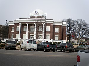 Dyer County Courthouse in Dyersburg | |
 Location within the U.S. state of Tennessee | |
 Tennessee's location within the U.S. | |
| Coordinates: 36°04′N 89°25′W / 36.06°N 89.41°W | |
| Country | |
| State | |
| Founded | 1823 |
| Named for | Robert Henry Dyer, state legislator[1] |
| Seat | Dyersburg |
| Largest city | Dyersburg |
| Area | |
| • Total | 527 sq mi (1,360 km2) |
| • Land | 512 sq mi (1,330 km2) |
| • Water | 14 sq mi (40 km2) 2.7%% |
| Population | |
| • Estimate (2018) | 37,320 |
| • Density | 75/sq mi (29/km2) |
| Time zone | UTC−6 (Central) |
| • Summer (DST) | UTC−5 (CDT) |
| Congressional district | 8th |
| Website | dyercounty |

Dyer County is a county located in the westernmost part of the U.S. state of Tennessee. As of the 2010 census, the population was 38,335.[2] The county seat is Dyersburg.[3]
Dyer County comprises the Dyersburg, TN Micropolitan Statistical Area.
History[]
Dyer County was founded by a Private Act of Tennessee, passed on October 16, 1823.[4] The area was part of the territory in Tennessee that was previously legally recognized as belonging to the Chickasaw Native Americans as "Indian Lands".[5]
The county was named for Robert Henry Dyer[6] (circa 1774—1826). Dyer had been an army officer in the Creek War and War of 1812, and a cavalry colonel in the First Seminole War of 1818 before becoming a state senator. He was instrumental in the formation of the counties of Dyer and Madison County, Tennessee.[7]
Around 1823, Louis Philippe I stopped briefly near the mouth of the Obion River and killed a bald eagle.[8]
On April 2, 2006 a severe weather system passed through Dyer County, producing tornadoes that killed 16 in the county and 24 in Tennessee.
Geography[]
According to the U.S. Census Bureau, the county has a total area of 527 square miles (1,360 km2), of which 512 square miles (1,330 km2) is land and 14 square miles (36 km2) (2.7%) is water.[9]
The county is drained by the Mississippi River, which forms its western boundary. It is in the part of Tennessee called the "Mississippi bottomland".[by whom?]
Dyer County is bisected by U.S. Route 51, the older major highway connecting Memphis with Chicago from south to north. When upgraded to interstate standards, this road will become Interstate 69. To the west, Dyer County is connected to Missouri by Interstate 155 over the Mississippi River, providing the only highway connection, other than those at Memphis, between Tennessee and the states to the west of the river.
Adjacent counties[]
- Lake County (north)
- Obion County (northeast)
- Gibson County (east)
- Crockett County (southeast)
- Lauderdale County (south)
- Mississippi County, Arkansas (southwest)
- Pemiscot County, Missouri (northwest)
Major highways[]
Demographics[]
| Historical population | |||
|---|---|---|---|
| Census | Pop. | %± | |
| 1830 | 1,904 | — | |
| 1840 | 4,484 | 135.5% | |
| 1850 | 6,361 | 41.9% | |
| 1860 | 10,536 | 65.6% | |
| 1870 | 13,706 | 30.1% | |
| 1880 | 15,118 | 10.3% | |
| 1890 | 19,878 | 31.5% | |
| 1900 | 23,776 | 19.6% | |
| 1910 | 27,721 | 16.6% | |
| 1920 | 29,983 | 8.2% | |
| 1930 | 31,405 | 4.7% | |
| 1940 | 34,920 | 11.2% | |
| 1950 | 33,473 | −4.1% | |
| 1960 | 29,537 | −11.8% | |
| 1970 | 30,427 | 3.0% | |
| 1980 | 34,663 | 13.9% | |
| 1990 | 34,854 | 0.6% | |
| 2000 | 37,279 | 7.0% | |
| 2010 | 38,335 | 2.8% | |
| 2018 (est.) | 37,320 | [10] | −2.6% |
| U.S. Decennial Census[11] 1790–1960[12] 1900–1990[13] 1990–2000[14] 2010–2014[2] | |||
As of the census[16] of 2000, there were 37,279 people, 14,751 households, and 10,458 families residing in the county. The population density was 73 people per square mile (28/km2). There were 16,123 housing units at an average density of 32 per square mile (12/km2). The racial makeup of the county was 85.40% White, 12.86% Black or African American, 0.22% Native American, 0.33% Asian, 0.02% Pacific Islander, 0.43% from other races, and 0.73% from two or more races. 1.16% of the population were Hispanic or Latino of any race.
There were 14,751 households, out of which 32.90% had children under the age of 18 living with them, 53.20% were married couples living together, 13.60% had a female householder with no husband present, and 29.10% were non-families. 25.30% of all households were made up of individuals, and 10.70% had someone living alone who was 65 years of age or older. The average household size was 2.49 and the average family size was 2.97.
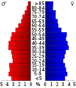
In the county, the age distribution of the population shows 25.70% under the age of 18, 8.70% from 18 to 24, 28.60% from 25 to 44, 23.50% from 45 to 64, and 13.40% who were 65 years of age or older. The median age was 36 years. For every 100 females there were 92.00 males. For every 100 females age 18 and over, there were 88.80 males.
The median income for a household in the county was $32,788, and the median income for a family was $39,848. Males had a median income of $31,182 versus $21,605 for females. The per capita income for the county was $16,451. About 13.00% of families and 15.90% of the population were below the poverty line, including 21.00% of those under age 18 and 17.60% of those age 65 or over.
Media[]
Newspapers[]
State Gazette – 3 days/week (Sunday, Tuesday, Thursday); general news. The paper has served Dyersburg and Northwest Tennessee since 1865.
Communities[]
Unincorporated communities[]
Politics[]
Like most of the rural South, Dyer County is presently overwhelmingly Republican. The last Democrat to carry this county was Bill Clinton in 1996. Being overwhelmingly secessionist during the Civil War due to the strong power of the slave economy in West Tennessee, Dyer County was overwhelmingly Democratic for a century after its blacks were disfranchised. Anti-Catholicism allowed Richard Nixon to carry the county narrowly in 1960, then after the massive revolt against the Civil Rights Act and race riots segregationist Alabama Governor George Wallace carried the county in 1968 and Nixon defeated George McGovern three-to-one in 1972. Since then the county has become increasingly Republican except when Southerners Jimmy Carter and Clinton headed the presidential ticket.
See also[]
- National Register of Historic Places listings in Dyer County, Tennessee
References[]
- ^ Carroll Van West, "Dyer County", Tennessee Encyclopedia of History and Culture. Retrieved: 27 June 2013.
- ^ Jump up to: a b "State & County QuickFacts". United States Census Bureau. Archived from the original on June 7, 2011. Retrieved November 29, 2013.
- ^ "Find a County". National Association of Counties. Archived from the original on 2012-07-12. Retrieved 2011-06-07.
- ^ "Tennessee State Archives — formation of Dyer county". Archived from the original on 2011-01-11. Retrieved 2010-12-01.
- ^ Bergeron, Paul H.; Ash, Stephen V.; Keith, Jeanette.Tennesseans and their history. Univ. of Tennessee Press, 1999, p. 78.
- ^ Gannett, Henry (1905). The Origin of Certain Place Names in the United States. Govt. Print. Off. pp. 112.
- ^ "Tennessee Blue Book — Dyer county" (PDF). Retrieved 2010-12-01.
- ^ Willoughby Jr., Earl (March 19, 2003). "John James Audubon and the 'Citizen King'". Dyersburg State Gazette. Retrieved September 28, 2019.
- ^ "2010 Census Gazetteer Files". United States Census Bureau. August 22, 2012. Retrieved April 4, 2015.
- ^ "Population and Housing Unit Estimates". Retrieved July 20, 2019.
- ^ "U.S. Decennial Census". United States Census Bureau. Retrieved April 4, 2015.
- ^ "Historical Census Browser". University of Virginia Library. Retrieved April 4, 2015.
- ^ Forstall, Richard L., ed. (March 27, 1995). "Population of Counties by Decennial Census: 1900 to 1990". United States Census Bureau. Retrieved April 4, 2015.
- ^ "Census 2000 PHC-T-4. Ranking Tables for Counties: 1990 and 2000" (PDF). United States Census Bureau. April 2, 2001. Retrieved April 4, 2015.
- ^ Based on 2000 census data
- ^ "U.S. Census website". United States Census Bureau. Retrieved 2011-05-14.
- ^ Leip, David. "Dave Leip's Atlas of U.S. Presidential Elections". uselectionatlas.org. Retrieved 2018-03-10.
External links[]
| Wikimedia Commons has media related to Dyer County, Tennessee. |
- Dyersburg-Dyer County Chamber of Commerce
- Dyer County Schools
- Dyer County, TNGenWeb – genealogy resources
- Dyer County at Curlie
| show Places adjacent to Dyer County, Tennessee |
|---|
| show Municipalities and communities of Dyer County, Tennessee, United States |
|---|

Coordinates: 36°04′N 89°25′W / 36.06°N 89.41°W
| show Authority control |
|---|
- Tennessee counties
- Dyer County, Tennessee
- 1823 establishments in Tennessee
- Populated places established in 1823
- Tennessee counties on the Mississippi River
- Second Amendment sanctuaries in Tennessee