McMinn County, Tennessee
McMinn County | |
|---|---|
U.S. county | |
 McMinn County Courthouse in Athens | |
 Seal | |
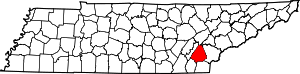 Location within the U.S. state of Tennessee | |
 Tennessee's location within the U.S. | |
| Coordinates: 35°25′N 84°37′W / 35.42°N 84.62°WCoordinates: 35°25′N 84°37′W / 35.42°N 84.62°W | |
| Country | |
| State | |
| Founded | 1819 |
| Named for | Joseph McMinn[1] |
| Seat | Athens |
| Largest city | Athens |
| Area | |
| • Total | 432 sq mi (1,120 km2) |
| • Land | 430 sq mi (1,100 km2) |
| • Water | 2.1 sq mi (5 km2) 0.5%% |
| Population (2010) | |
| • Total | 52,266 |
| • Density | 122/sq mi (47/km2) |
| Time zone | UTC−5 (Eastern) |
| • Summer (DST) | UTC−4 (EDT) |
| Congressional district | 3rd |
| Website | mcminncountytn |

McMinn County is a county in the U.S. state of Tennessee. It is located in East Tennessee. As of the 2010 census, the population was 52,266.[2] Its county seat is Athens.[3]
McMinn County comprises the Athens, TN Micropolitan Statistical Area, which is also included in the Chattanooga-Cleveland-Dalton, TN-GA-AL Combined Statistical Area.
History[]
McMinn County was created in 1819 from Indian lands and was named in honor of Joseph McMinn (1758–1824).[1] McMinn was a militia commander during the Revolutionary War, a member of the territorial legislature, speaker of the state senate, and eventually governor of the state of Tennessee. McMinn died on October 17, 1824, and is buried at Shiloh Presbyterian Cemetery in Calhoun.[4]
The first railroad in East Tennessee, the Hiwassee Railroad, began construction in McMinn County in the late 1830s, but was halted due to financial difficulties. Work was resumed by the East Tennessee and Georgia Railroad (ET&G) in 1849, and by the mid-1850s rail lines connected Chattanooga, Knoxville, and the Tri-Cities. The ET&G was headquartered in Athens before moving to Knoxville in 1855.[1] A train depot from this early railroad period still stands in Niota. A number of communities sprang up along the railroads in subsequent years, most notably Etowah, where the L&N built a large depot in the early 1900s, and Englewood, which developed into a textile manufacturing center in the late 19th and early 20th centuries.[1]
Like many East Tennessee counties, McMinn was polarized by the Civil War and the issue of secession.[1] On June 8, 1861, the county voted against secession by a margin of 1,144 to 904.[5] The county provided twelve regiments for the Union Army and eight for the Confederate Army during the course of the war.[5]
In August 1946, an uprising known as the Battle of Athens erupted when the McMinn County sheriff and several other county officials (most of whom had ties to Memphis political boss E.H. Crump) attempted to fix local elections. A group of World War II veterans launched an armed assault on the jail in Athens, where the county officials had retreated with the ballot boxes. After an exchange of gunfire, the county officials turned over the ballot boxes, and the votes were counted in a public setting.[6][7]
Geography[]

According to the U.S. Census Bureau, the county has a total area of 432 square miles (1,120 km2), of which 430 square miles (1,100 km2) is land and 2.1 square miles (5.4 km2) (0.5%) is water.[8] The Hiwassee River forms the county's border with Bradley County to the southwest. Starr Mountain, a large ridge in the southeastern part of the county, forms part of the county's border with Polk County to the south and Monroe County to the north and east.
Adjacent counties[]
- Roane County (north)
- Loudon County (northeast)
- Monroe County (east)
- Polk County (southeast)
- Bradley County (southwest)
- Meigs County (west)
National protected area[]
- Cherokee National Forest (part)
State protected area[]
- Chickamauga Wildlife Management Area (part)
Demographics[]
| Historical population | |||
|---|---|---|---|
| Census | Pop. | %± | |
| 1820 | 1,623 | — | |
| 1830 | 14,460 | 790.9% | |
| 1840 | 12,719 | −12.0% | |
| 1850 | 13,906 | 9.3% | |
| 1860 | 13,555 | −2.5% | |
| 1870 | 13,969 | 3.1% | |
| 1880 | 15,064 | 7.8% | |
| 1890 | 17,890 | 18.8% | |
| 1900 | 19,163 | 7.1% | |
| 1910 | 21,046 | 9.8% | |
| 1920 | 25,133 | 19.4% | |
| 1930 | 29,019 | 15.5% | |
| 1940 | 30,781 | 6.1% | |
| 1950 | 32,024 | 4.0% | |
| 1960 | 33,662 | 5.1% | |
| 1970 | 35,462 | 5.3% | |
| 1980 | 41,878 | 18.1% | |
| 1990 | 42,383 | 1.2% | |
| 2000 | 49,015 | 15.6% | |
| 2010 | 52,266 | 6.6% | |
| 2018 (est.) | 53,285 | [9] | 1.9% |
| U.S. Decennial Census[10] 1790–1960[11] 1900–1990[12] 1990–2000[13] 2010–2014[2] | |||

2010 census[]
As of the census of 2010,[15] there were 52,266 people, 20,865 households, and 14,632 families living in the county. The population density was 121.55 persons per square mile and the housing unit density was 48.52 units per square mile. The racial makeup of the county was 91.96% White, 3.95% Black, 0.34% Native American, 0.74% Asian, 0.02% Pacific Islander, and 1.79% from two or more races. Those of Hispanic of Latino origins made up 2.84% of the population.
Of all of the households, 26.93% had children under the age of 18 living in them, 53.88% were married couples living together, 4.86% had a male householder with no wife present, 11.38% had a female householder with no husband present, and 29.87% were non families. 26.02% of all households were made up of individuals, and 11.65% had someone living alone who was 65 years of age or older. The average household size was 2.46 and the average family size was 2.94.
The population was distributed with 22.57% under the age of 18, 60.57% ages 18 to 64, and 16.86% age 65 years and older. The median age was 40.4 years. 51.43% of the population were females and 48.57% were males.
The median household income was $37,146 and the median family income was $47,726. Males had a median income of $38,459 versus $31,342 for females. The per capita income for the county was $19,796. About 13.7% of families and 17.3% of the population were below the poverty line, including 24.0% of those under the age of 18 and 11.9% of those over the age of 65.
2000 census[]
At the 2000 census,[16] there were 49,015 people, 19,721 households and 14,317 families living in the county. The population density was 114 per square mile (44/km2). There were 21,626 housing units at an average density of 50 per square mile (19/km2). The racial makeup of the county was 92.72% White, 4.48% Black or African American, 0.27% Native American, 0.70% Asian, 0.02% Pacific Islander, 0.75% from other races, and 1.06% from two or more races. 1.80% of the population were Hispanic or Latino of any race.
There were 19,721 households, of which 31.40% had children under the age of 18 living with them, 58.70% were married couples living together, 10.60% had a female householder with no husband present, and 27.40% were non-families. 24.40% of all households were made up of individuals, and 10.40% had someone living alone who was 65 years of age or older. The average household size was 2.45 and the average family size was 2.90.
Age distribution was 23.90% under the age of 18, 8.40% from 18 to 24, 28.50% from 25 to 44, 24.80% from 45 to 64, and 14.30% who were 65 years of age or older. The median age was 38 years. For every 100 females there were 93.40 males. For every 100 females age 18 and over, there were 89.80 males.
The median household income was $31,919, and the median family income was $38,992. Males had a median income of $31,051 versus $20,524 for females. The per capita income for the county was $16,725. About 10.90% of families and 14.50% of the population were below the poverty line, including 18.20% of those under age 18 and 16.80% of those age 65 or over.
Communities[]
Cities[]
- Athens (county seat)
- Etowah
- Niota
- Sweetwater
Towns[]
Census-designated place[]
Unincorporated communities[]
- Claxton
- Conasauga
- Goodsprings
- Liberty Hill
- Mount Verd
- Reagan
- Regret (historical)
- Spring Creek
- Williamsburg
Politics[]
See also[]
References[]
- ^ Jump up to: a b c d e Bill Akins, "McMinn County", Tennessee Encyclopedia of History and Culture. Retrieved: March 11, 2013.
- ^ Jump up to: a b "State & County QuickFacts". United States Census Bureau. Archived from the original on June 7, 2011. Retrieved December 6, 2013.
- ^ "Find a County". National Association of Counties. Retrieved June 7, 2011.
- ^ John Thweatt, "Joseph McMinn," Tennessee Encyclopedia of History and Culture. Retrieved: March 11, 2013.
- ^ Jump up to: a b C. Stephen Byrum, McMinn County (Memphis, Tenn: Memphis State University Press, 1984), pp. 23-32.
- ^ Information obtained from Tennessee Historical Commission marker 2A 102 in Athens, Tennessee. Information accessed: November 26, 2007.
- ^ Derose, Chris (November 1, 2020). "'Get the Hell Out of Here and Get Something to Shoot With'". Politico. Retrieved November 2, 2020.
- ^ "2010 Census Gazetteer Files". United States Census Bureau. August 22, 2012. Retrieved April 9, 2015.
- ^ "Population and Housing Unit Estimates". Retrieved July 20, 2019.
- ^ "U.S. Decennial Census". United States Census Bureau. Retrieved April 9, 2015.
- ^ "Historical Census Browser". University of Virginia Library. Retrieved April 9, 2015.
- ^ Forstall, Richard L., ed. (March 27, 1995). "Population of Counties by Decennial Census: 1900 to 1990". United States Census Bureau. Retrieved April 9, 2015.
- ^ "Census 2000 PHC-T-4. Ranking Tables for Counties: 1990 and 2000" (PDF). United States Census Bureau. April 2, 2001. Retrieved April 9, 2015.
- ^ Based on 2000 census data
- ^ "U.S. Census website". United States Census Bureau. Retrieved October 5, 2019.
- ^ "U.S. Census website". United States Census Bureau. Retrieved May 14, 2011.
- ^ Leip, David. "Dave Leip's Atlas of U.S. Presidential Elections". uselectionatlas.org.
Further reading[]
- Byrum, Stephen C. McMinn County. Memphis: Memphis State University Press (1984). ISBN 978-0878701766.
- Guy, Joe. The Hidden History of McMinn County: Tales From Eastern Tennessee. Charleston: The History Press (2007). ISBN 1-59629-349-7.
External links[]
| Wikimedia Commons has media related to McMinn County, Tennessee. |
- Official site
- McMinn County, TNGenWeb – free genealogy resources for the county
- McMinn County at Curlie
| show Places adjacent to McMinn County, Tennessee |
|---|
| show Municipalities and communities of McMinn County, Tennessee, United States |
|---|

| show Authority control |
|---|
- Tennessee counties
- McMinn County, Tennessee
- 1819 establishments in Tennessee
- Populated places established in 1819
- Counties of Appalachia