Robertson County, Tennessee
Robertson County | |
|---|---|
U.S. county | |
| County of Robertson | |
 Robertson County courthouse in Springfield | |
 Seal | |
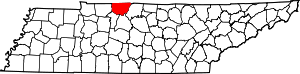 Location within the U.S. state of Tennessee | |
 Tennessee's location within the U.S. | |
| Coordinates: 36°32′N 86°52′W / 36.53°N 86.87°W | |
| Country | |
| State | |
| Founded | April 9, 1796 |
| Named for | James Robertson[1] |
| Seat | Springfield |
| Largest city | Springfield |
| Area | |
| • Total | 476 sq mi (1,230 km2) |
| • Land | 476 sq mi (1,230 km2) |
| • Water | 0.2 sq mi (0.5 km2) 0.04%% |
| Population | |
| • Estimate (2020) | 72,275 |
| • Density | 145/sq mi (56/km2) |
| Time zone | UTC−6 (Central) |
| • Summer (DST) | UTC−5 (CDT) |
| Congressional district | 6th |
| Website | www |

Robertson County is a county located on the central northern border of Tennessee in the United States. As of the 2010 census, the population was 66,283.[2] Its county seat is Springfield.[3] The county was named for James Robertson, an explorer, founder of Nashville, and a state senator, who was often called the "Father of Middle Tennessee". Robertson County is a component of the Nashville-Davidson–Murfreesboro–Franklin, TN Metropolitan Statistical Area. In 2002 Howard Bradley became the mayor of Robertson County. Bradley was re-elected and served as Mayor until 2018, when he was succeeded by Billy Vogle, the current incumbent.[4]
History[]
This was part of the Miro District (also spelled Mero), named after the Spanish Governor Esteban Rodríguez Miró of what was then Louisiana on the west side of the Mississippi River. Miró had served with Spanish troops that assisted the Americans during their war for independence. James Robertson, the explorer for whom this county was named, was trying to create an alliance with Miró that would allow free movement on the Mississippi River (which Spain controlled) to settlers on the Cumberland frontier. Before statehood, this territory was known as Tennessee County.
It was organized as Robertson County in 1796, at the same time as Montgomery County, which had also been part of the Miro district. The county seat, Springfield, Tennessee, was laid out in 1798. Although initially most settlers did not hold slaves, by the 1820s planters began to cultivate tobacco, a commodity crop that was labor-intensive and depended on enslaved African Americans. The planters bought slaves to work their plantations, as well as to care for the livestock they bred - thoroughbred horses and cattle.
By the time of the Civil War, African Americans comprised about one-quarter of the area's population, typical for Middle Tennessee, where tobacco and hemp were commodity crops. During the Civil War, Tennessee was occupied by the Union from 1862, which led to a breakdown in social organization in Middle Tennessee.[5]
By 1910 the county's population was 25,466, including 6,492 black citizens, who continued to make up one-quarter of the total. Most of the residents were still involved in farm work, and tobacco was the primary commodity crop, but agricultural mechanization was reducing the need for laborers. White conservative Democrats had tried to restrict black voting; other southern states had totally excluded blacks from the political process. Many African Americans left rural Robertson County and other parts of Tennessee in the Great Migration to northern and midwestern cities for employment and social freedom. Combined with later in-migration of whites to the county, by the early 21st century, African Americans comprised less than 10 percent of the county population. They live chiefly in its larger towns.
Geography[]
According to the U.S. Census Bureau, the county has a total area of 476 square miles (1,230 km2), of which 476 square miles (1,230 km2) is land and 0.2 square miles (0.52 km2) (0.04%) is water.[6]
Adjacent counties[]
- Logan County, Kentucky (north)
- Simpson County, Kentucky (northeast)
- Sumner County (east)
- Davidson County (south)
- Cheatham County (southwest)
- Montgomery County (west)
- Todd County, Kentucky (northwest)
State protected areas[]
- Cedar Hill Swamp Wildlife Management Area
- Port Royal State Park (part)
Demographics[]
| Historical population | |||
|---|---|---|---|
| Census | Pop. | %± | |
| 1800 | 4,280 | — | |
| 1810 | 7,270 | 69.9% | |
| 1820 | 9,938 | 36.7% | |
| 1830 | 13,372 | 34.6% | |
| 1840 | 13,801 | 3.2% | |
| 1850 | 16,145 | 17.0% | |
| 1860 | 15,265 | −5.5% | |
| 1870 | 16,166 | 5.9% | |
| 1880 | 18,861 | 16.7% | |
| 1890 | 20,078 | 6.5% | |
| 1900 | 25,029 | 24.7% | |
| 1910 | 25,466 | 1.7% | |
| 1920 | 25,621 | 0.6% | |
| 1930 | 28,191 | 10.0% | |
| 1940 | 29,046 | 3.0% | |
| 1950 | 27,024 | −7.0% | |
| 1960 | 27,335 | 1.2% | |
| 1970 | 29,102 | 6.5% | |
| 1980 | 37,021 | 27.2% | |
| 1990 | 41,494 | 12.1% | |
| 2000 | 54,433 | 31.2% | |
| 2010 | 66,238 | 21.7% | |
| 2020 (est.) | 72,275 | [7] | 9.1% |
| U.S. Decennial Census[8] 1790-1960[9] 1900-1990[10] 1990-2000[11] 2010-2014[2] | |||

As of the census[13] of 2000, there were 54,433 people, 19,906 households, and 15,447 families residing in the county. The population density was 114 people per square mile (44/km2). There were 20,995 housing units at an average density of 44 per square mile (17/km2). The racial makeup of the county was 89.13% White, 8.62% Black or African American, 0.28% Native American, 0.31% Asian, 0.02% Pacific Islander, 0.83% from other races, and 0.80% from two or more races. 2.66% of the population were Hispanic or Latino of any race.
In 2005 the racial makeup of the county was 85.4% non-Hispanic whites, 8.3% African Americans, and 5.3% Latinos.
There were 19,906 households, out of which 37.40% had children under the age of 18 living with them, 61.90% were married couples living together, 11.20% had a female householder with no husband present, and 22.40% were non-families. 18.60% of all households were made up of individuals, and 7.50% had someone living alone who was 65 years of age or older. The average household size was 2.71 and the average family size was 3.06.
In the county, the population was spread out, with 26.80% under the age of 18, 8.50% from 18 to 24, 31.40% from 25 to 44, 22.50% from 45 to 64, and 10.80% who were 65 years of age or older. The median age was 35 years. For every 100 females, there were 98.80 males. For every 100 females age 18 and over, there were 95.70 males.
The median income for a household in the county was $43,174, and the median income for a family was $49,412. Males had a median income of $34,895 versus $24,086 for females. The per capita income for the county was $19,054. About 6.40% of families and 9.00% of the population were below the poverty line, including 10.90% of those under age 18 and 13.10% of those age 65 or over.
Communities[]
Cities[]
- Adams
- Cedar Hill
- Cross Plains
- Greenbrier
- Millersville (mostly in Sumner County)
- Orlinda
- Portland (partly in Sumner County)
- Ridgetop (partly in Davidson County)
- Springfield (county seat)
- White House (mostly in Sumner County)
Towns[]
Unincorporated communities[]
Transportation[]
Interstate 65 runs along the eastern border of the county for about 20 miles (32 km), and Interstate 24 runs along the southwestern border of the county for about 10 miles (16 km). U.S. Routes 41 and 431 run through the county, intersecting and briefly forming a concurrency in Springfield. Major state routes include 25, 49, 52, 76, and 109. Secondary state routes in Robertson County include 161, 256, and 257.[14]
Politics[]
See also[]
References[]
- ^ Yolanda Reid, "Robertson County," Tennessee Encyclopedia of History and Culture. Retrieved: March 21, 2013.
- ^ Jump up to: a b "State & County QuickFacts". United States Census Bureau. Archived from the original on July 17, 2011. Retrieved December 7, 2013.
- ^ "Find a County". National Association of Counties. Retrieved June 7, 2011.
- ^ County Mayor, Robertson County
- ^ Durham, Walter T. Rebellion Revisited: A History of Sumner County, Tennessee from 1861 to 1870(Franklin, Tennessee: Hillsboro Press, 1999, 2nd ed.)
- ^ "2010 Census Gazetteer Files". United States Census Bureau. August 22, 2012. Retrieved April 14, 2015.
- ^ "Population and Housing Unit Estimates". Retrieved July 20, 2019.
- ^ "U.S. Decennial Census". United States Census Bureau. Retrieved April 14, 2015.
- ^ "Historical Census Browser". University of Virginia Library. Retrieved April 14, 2015.
- ^ Forstall, Richard L., ed. (March 27, 1995). "Population of Counties by Decennial Census: 1900 to 1990". United States Census Bureau. Retrieved April 14, 2015.
- ^ "Census 2000 PHC-T-4. Ranking Tables for Counties: 1990 and 2000" (PDF). United States Census Bureau. April 2, 2001. Retrieved April 14, 2015.
- ^ Based on 2000 census data
- ^ "U.S. Census website". United States Census Bureau. Retrieved May 14, 2011.
- ^ Tennessee Department of Transportation Long Range Planning Division Office of Data Visualization (2018). Robertson County (PDF) (Map). Tennessee Department of Transportation.
- ^ Leip, David. "Dave Leip's Atlas of U.S. Presidential Elections". uselectionatlas.org. Retrieved March 12, 2018.
External links[]
| Wikimedia Commons has media related to Robertson County, Tennessee. |
- Official site
- Robertson County History in state encyclopedia
- Robertson County, Tenn GenWeb - free genealogy resources for the county
- Robertson County at Curlie
- Robertson County Chamber of Commerce Archived November 25, 2010, at the Wayback Machine
- Robertson County Schools
| show Places adjacent to Robertson County, Tennessee |
|---|
| show Municipalities and communities of Robertson County, Tennessee, United States |
|---|

| show Authority control |
|---|
- Tennessee counties
- Robertson County, Tennessee
- Nashville metropolitan area
- 1796 establishments in Tennessee
- Populated places established in 1796