Montville, Seine-Maritime
Montville | |
|---|---|
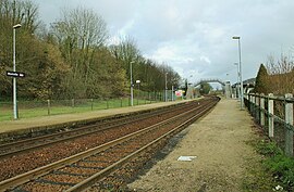 Montville railway station | |
 Coat of arms | |
show Location of Montville | |
 Montville | |
| Coordinates: 49°32′50″N 1°04′35″E / 49.5472°N 1.0764°ECoordinates: 49°32′50″N 1°04′35″E / 49.5472°N 1.0764°E | |
| Country | France |
| Region | Normandy |
| Department | Seine-Maritime |
| Arrondissement | Rouen |
| Canton | Bois-Guillaume |
| Intercommunality | Inter-Caux-Vexin |
| Government | |
| • Mayor (2020–2026) | Anne-Sophie Clabaut[1] |
| Area 1 | 10.85 km2 (4.19 sq mi) |
| Population (Jan. 2018)[2] | 4,661 |
| • Density | 430/km2 (1,100/sq mi) |
| Time zone | UTC+01:00 (CET) |
| • Summer (DST) | UTC+02:00 (CEST) |
| INSEE/Postal code | 76452 /76710 |
| Elevation | 42–178 m (138–584 ft) (avg. 51 m or 167 ft) |
| 1 French Land Register data, which excludes lakes, ponds, glaciers > 1 km2 (0.386 sq mi or 247 acres) and river estuaries. | |


Montville (French pronunciation: [mɔ̃vil]) is a commune in the Seine-Maritime department in the Normandy region in north-western France.
On August 19, 1845, A violent F5 tornado hit montville, killing 75. it travelled 15 km with an average width of about 300 meters. [3]
Geography[]
A small town of forestry farming and light industry situated some 9 miles (14 km) north of Rouen at the junction of the D44, D51 and the D155 roads. SNCF operates a TER train service here. Two small rivers meet here, the Clérette and the Cailly.
Heraldry[]
 |
The arms of Montville are blazoned : Per fess wavy azure and gules, a barrulet wavy between (in chief) in fess, a toothed wheel between 2 weavers shuttles palewise, and (in base) a plough argent.
|
Population[]
| Year | Pop. | ±% p.a. |
|---|---|---|
| 1968 | 4,139 | — |
| 1975 | 4,111 | −0.10% |
| 1982 | 4,365 | +0.86% |
| 1990 | 4,252 | −0.33% |
| 1999 | 4,644 | +0.98% |
| 2007 | 4,564 | −0.22% |
| 2012 | 4,795 | +0.99% |
| 2017 | 4,760 | −0.15% |
| Source: INSEE[4] | ||
Places of interest[]
- The church of Notre-Dame de l'Assomption, dating from the eleventh century.
- A seventeenth century chapel.
- The château, dating from the nineteenth century.
- The National Firefighters Museum.
- Several interesting old buildings dating from the seventeenth century.
- The mairie, housing a tricolor dating from 1789.
Twin towns[]
 Haiger (Hesse, Germany)
 Santa Eulàlia de Ronçana (Catalonia, Spain)
See also[]
- Communes of the Seine-Maritime department
References[]
- ^ "Répertoire national des élus: les maires". data.gouv.fr, Plateforme ouverte des données publiques françaises (in French). 2 December 2020. Retrieved 7 December 2020.
- ^ "Populations légales 2018". INSEE. 28 December 2020.
- ^ https://www.keraunos.org/actualites/faits-marquants/1800-1849/tornade-montville-19-aout-1845-ef5-seine-maritime-normandie-violente-tornade-en-france.html
- ^ Population en historique depuis 1968, INSEE
External links[]
| Wikimedia Commons has media related to Montville. |
- Official website of Montville (in French)
- Museum of the Sapeurs Pompiers (in French)
| show Communes of the Seine-Maritime department |
|---|
Categories:
- Communes of Seine-Maritime
- Rouen geography stubs