[2] Name on the Register
Image
Date listed[3]
Location
City or town
Description
1
Acworth Downtown Historic District
April 19, 2006 (#06000286 ) Roughly bounded by Southside Dr., Federal and Lemon Sts, and Senator Richard B. Russell Ave. 34°03′58″N 84°40′44″W / 34.066111°N 84.678889°W / 34.066111; -84.678889 (Acworth Downtown Historic District ) Acworth
2
June 20, 1995 (#95000737 ) Atlanta and Frasier Sts. between GA 120 Loop and Dixie Ave. 33°56′43″N 84°32′47″W / 33.945278°N 84.546389°W / 33.945278; -84.546389 (Atlanta-Frasier Street Historic District ) Marietta
3
Upload image November 25, 1994 (#94001387 ) 901 Industrial Dr., Dobbins Air Reserve Base 33°55′30″N 84°31′36″W / 33.92513°N 84.52672°W / 33.92513; -84.52672 (J. C. Bankston Rock House ) Marietta
4
May 9, 2002 (#02000453 ) 4683 Bell St. 34°04′07″N 84°40′41″W / 34.068611°N 84.678056°W / 34.068611; -84.678056 (Bethel AME Church ) Acworth
5
March 20, 1980 (#80000995 ) Park Ave., Whitfield Pl., Main, Harris, Lewis, and Cherokee Sts. 34°01′27″N 84°36′54″W / 34.024167°N 84.615°W / 34.024167; -84.615 (Big Shanty Village Historic District ) Kennesaw
6
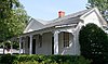
Braswell-Carnes House
March 1, 1984 (#84000974 ) 2430 Burnt Hickory Rd., NW 33°57′57″N 84°37′21″W / 33.96586°N 84.62263°W / 33.96586; -84.62263 (Braswell-Carnes House ) Marietta
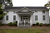
7
Arnoldus Brumby House
August 29, 1977 (#77000417 ) 472 Powder Springs St. 33°56′37″N 84°33′08″W / 33.943611°N 84.552222°W / 33.943611; -84.552222 (Arnoldus Brumby House ) Marietta
8
February 2, 1995 (#94001637 ) 2382 Pine Mountain Rd., NW. 34°00′35″N 84°37′47″W / 34.009722°N 84.629722°W / 34.009722; -84.629722 (Hiram Butler House ) Kennesaw
9
February 1, 2006 (#05001593 ) 4455 Marietta St. 33°51′32″N 84°41′04″W / 33.858889°N 84.684444°W / 33.858889; -84.684444 (Butner-Mctyre General Store ) Powder Springs
10
March 20, 1980 (#80000996 ) Off U.S. 41 34°01′18″N 84°37′05″W / 34.021667°N 84.618056°W / 34.021667; -84.618056 (Camp McDonald ) Kennesaw
11
Upload image June 30, 1980 (#80001002 ) SE of Smyrna at 501 Log Cabin Rd. 33°50′36″N 84°29′02″W / 33.843333°N 84.483889°W / 33.843333; -84.483889 (J. H. Carmichael Farm and General Store ) Smyrna
12
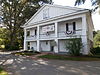
August 13, 1975 (#75000584 ) 5909 Maxham Rd. 33°48′36″N 84°37′05″W / 33.81°N 84.618056°W / 33.81; -84.618056 (Israel Causey House ) Austell
13
Andrew J. Cheney House
July 22, 1979 (#79000713 ) SW of Marietta at Powder Springs and Bankstone Rds. 33°53′07″N 84°37′07″W / 33.88524°N 84.61854°W / 33.88524; -84.61854 (Andrew J. Cheney House ) Marietta
14
March 20, 1980 (#80000997 ) Cherokee St. 34°01′34″N 84°36′36″W / 34.026111°N 84.61°W / 34.026111; -84.61 (Cherokee Street Historic District ) Kennesaw
15
Upload image December 3, 1985 (#85003059 ) Roughly bounded by Margaret Ave. and Chicopee Dr., DeSoto Ave., Montgomery and Brumby, and Campbell Hill Sts. 33°57′44″N 84°32′53″W / 33.962222°N 84.548056°W / 33.962222; -84.548056 (Church Street-Cherokee Street Historic District ) Marietta
16
December 23, 1987 (#87002134 ) Powder Springs-Austell Rd. 33°49′48″N 84°39′15″W / 33.83°N 84.654167°W / 33.83; -84.654167 (Clarkdale Historic District ) Clarkdale
17
July 5, 2001 (#01000707 ) Collins Ave. 34°04′00″N 84°41′10″W / 34.066667°N 84.686111°W / 34.066667; -84.686111 (Collins Avenue Historic District ) Acworth
18
November 15, 2002 (#02001299 ) 4940 Cowan Rd. 34°04′24″N 84°39′18″W / 34.073333°N 84.655°W / 34.073333; -84.655 (Stephen D. Cowan House ) Acworth
19
Frobel-Knight-Borders House Upload image July 21, 1995 (#95000901 ) 1001 Allgood Rd. 33°58′31″N 84°31′25″W / 33.975278°N 84.523611°W / 33.975278; -84.523611 (Frobel-Knight-Borders House ) Marietta
20
The General
June 19, 1973 (#73000617 ) Big Shanty Museum of Cherokee St.34°01′25″N 84°36′52″W / 34.023611°N 84.614444°W / 34.023611; -84.614444 (The General ) Kennesaw Subject of the Great Locomotive Chase of the American Civil War, located at Southern Museum of Civil War and Locomotive History
21
January 23, 1975 (#75000585 ) 9 mi (14 km) W of Marietta on Sandtown Rd. 33°58′18″N 84°39′54″W / 33.971667°N 84.665°W / 33.971667; -84.665 (Gilgal Church Battle Site ) Marietta
22
Glover-McLeod-Garrison House
March 25, 1977 (#77000418 ) 250 Garrison Rd., SE (that part of the street is called Magnolia Chase Dr as of 2017) 33°56′07″N 84°32′52″W / 33.93514°N 84.54785°W / 33.93514; -84.54785 (Glover-McLeod-Garrison House ) Marietta
23
Johnston's River Line Upload image July 5, 1973 (#73000618 ) SE of Mableton off U.S. 78 at Chattachooche River 33°47′31″N 84°31′23″W / 33.791944°N 84.523056°W / 33.791944; -84.523056 (Johnston's River Line ) Mableton Boundary increase May 18, 2015.
24
Kennesaw Mountain National Battlefield Park
October 15, 1966 (#66000063 ) 2 mi (3.2 km) W of Marietta 33°56′59″N 84°35′37″W / 33.949722°N 84.593611°W / 33.949722; -84.593611 (Kennesaw Mountain National Battlefield Park ) Marietta administered by the National Park Service
25
January 7, 2010 (#09001202 ) Lakeshore Dr. 34°03′39″N 84°40′56″W / 34.060706°N 84.682208°W / 34.060706; -84.682208 (Lake Acworth Beach and Bathhouse ) Acworth
26
Robert Mable House and Cemetery
September 1, 1988 (#87001345 ) 5239 Floyd Rd. 33°49′37″N 84°34′25″W / 33.826944°N 84.573611°W / 33.826944; -84.573611 (Robert Mable House and Cemetery ) Mableton
27
Marietta National Cemetery
September 18, 1998 (#98001170 ) 500 Washington Ave. 33°57′04″N 84°32′27″W / 33.951111°N 84.540833°W / 33.951111; -84.540833 (Marietta National Cemetery ) Marietta
28
William Gibbs McAdoo House
November 17, 1978 (#78000975 ) SW of Marietta on GA 5 33°54′28″N 84°36′15″W / 33.907778°N 84.604167°W / 33.907778; -84.604167 (William Gibbs McAdoo House ) Marietta
29
Midway Presbyterian Church and Cemetery
December 29, 1986 (#86003526 ) 4635 Dallas Hwy./GA 120 SW 33°56′37″N 84°41′15″W / 33.943611°N 84.6875°W / 33.943611; -84.6875 (Midway Presbyterian Church and Cemetery ) Powder Springs
30
May 31, 2006 (#06000453 ) 4784 Northside Dr. 34°04′12″N 84°41′12″W / 34.07°N 84.686667°W / 34.07; -84.686667 (Tarleton Moore House ) Acworth
31
March 20, 1980 (#80000999 ) N. Main St. 34°01′33″N 84°37′14″W / 34.025833°N 84.620556°W / 34.025833; -84.620556 (North Main Street Historic District ) Kennesaw
32
Northwest Marietta Historic District
June 11, 1975 (#75000586 ) Roughly bounded by RR tracks, NW along Kennesaw Ave., McDonald St., and Whitlock Ave. 33��57′36″N 84°33′22″W / 33.96°N 84.556111°W / 33.96; -84.556111 (Northwest Marietta Historic District ) Marietta
33
May 20, 2009 (#09000325 ) 3057 Paces Mill Rd. 33°52′01″N 84°27′53″W / 33.86694°N 84.46472°W / 33.86694; -84.46472 (Solomon and Penelopy Pace House ) Vinings
34
July 11, 2001 (#01000720 ) Hyde Rd. 33°57′38″N 84°23′42″W / 33.960556°N 84.395°W / 33.960556; -84.395 (George A. Power House ) Marietta
35
April 8, 1983 (#83000189 ) 254 Concord Rd. 33°50′59″N 84°33′33″W / 33.849722°N 84.559167°W / 33.849722; -84.559167 (John W. Rice Summer Cottage ) Smyrna
36
January 27, 1995 (#94001639 ) 7561 Six Flags Pkwy. 33°46′00″N 84°33′03″W / 33.766667°N 84.550833°W / 33.766667; -84.550833 (Riverview Carousel at Six Flags Over Georgia ) Austell A carousel at Six Flags Over Georgia
37
March 12, 2014 (#14000061 ) 145 Denmead St., NW. 33°57′16″N 84°33′07″W / 33.9545515°N 84.5518412°W / 33.9545515; -84.5518412 (William and Hannah Root House ) Marietta In the Northwest Marietta Historic District
38
Ruff's Mill and Concord Covered Bridge
November 24, 1980 (#80001001 ) 10 Concord Rd., SW 33°50′56″N 84°33′30″W / 33.848889°N 84.558333°W / 33.848889; -84.558333 (Ruff's Mill and Concord Covered Bridge ) Smyrna
39
December 2, 2014 (#14000969 ) 360 Manning Rd. 33°56′38″N 84°34′56″W / 33.943866°N 84.582099°W / 33.943866; -84.582099 (Smith-Manning House ) Marietta
40
Sope Creek Ruins
April 27, 1973 (#73000619 ) Address Restricted (at the intersection of Paper Mill Road and Sope Creek) 33°56′26″N 84°26′16″W / 33.94045°N 84.4378°W / 33.94045; -84.4378 (Sope Creek Ruins ) Marietta
41
March 20, 1980 (#80001000 ) Summers St. 34°01′10″N 84°36′49″W / 34.019444°N 84.613611°W / 34.019444; -84.613611 (Summers Street Historic District ) Kennesaw
42
March 27, 2012 (#12000149 ) 3180 Atlanta Rd 33°52′32″N 84°30′24″W / 33.87553°N 84.50678°W / 33.87553; -84.50678 (Taylor-Brawner House and Brawner Sanitarium ) Smyrna website
43
May 18, 2015 (#15000223 ) 6000 Henderson Rd., SE. 33°48′24″N 84°31′21″W / 33.8066°N 84.5225°W / 33.8066; -84.5225 (Union Field Fortifications at Henderson Road ) Mableton vicinity
44
Upload image August 10, 1989 (#89001102 ) Roughly bounded by Lawrence St., Rigsby St., Washington Ave., and Haynes St. 33°57′09″N 84°32′36″W / 33.9525°N 84.543333°W / 33.9525; -84.543333 (Washington Avenue Historic District ) Marietta
45
Whitlock Avenue Historic District Upload image September 14, 1989 (#89001218 ) Roughly bounded by McCord St., Oakmont St., Whitlock Ave., Powder Springs Rd., Trammel St., Maxwell Ave., and Hazel St. 33°57′04″N 84°33′26″W / 33.951111°N 84.557222°W / 33.951111; -84.557222 (Whitlock Avenue Historic District ) Marietta
46
Zion Baptist Church
July 11, 1990 (#90001026 ) 149 Haynes St. 33°57′18″N 84°32′51″W / 33.955°N 84.5475°W / 33.955; -84.5475 (Zion Baptist Church ) Marietta