Reuville
Reuville | |
|---|---|
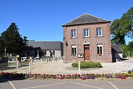 The town hall and church in Reuville | |
show Location of Reuville | |
 Reuville | |
| Coordinates: 49°45′06″N 0°52′07″E / 49.7517°N 0.8686°ECoordinates: 49°45′06″N 0°52′07″E / 49.7517°N 0.8686°E | |
| Country | France |
| Region | Normandy |
| Department | Seine-Maritime |
| Arrondissement | Rouen |
| Canton | Yvetot |
| Intercommunality | Plateau de Caux-Doudeville-Yerville |
| Government | |
| • Mayor (2014-2020) | Yves Hubert |
| Area 1 | 4.37 km2 (1.69 sq mi) |
| Population (Jan. 2018)[1] | 129 |
| • Density | 30/km2 (76/sq mi) |
| Time zone | UTC+01:00 (CET) |
| • Summer (DST) | UTC+02:00 (CEST) |
| INSEE/Postal code | 76524 /76560 |
| Elevation | 117–152 m (384–499 ft) (avg. 143 m or 469 ft) |
| 1 French Land Register data, which excludes lakes, ponds, glaciers > 1 km2 (0.386 sq mi or 247 acres) and river estuaries. | |


Reuville is a commune in the Seine-Maritime department in the Normandy region in northern France.
Geography[]
A small farming village situated in the Pays de Caux, some 27 miles (43 km) north of Rouen at the junction of the D50 and the D149 roads.
Population[]
| Year | Pop. | ±% |
|---|---|---|
| 2005 | 128 | — |
| 2006 | 122 | −4.7% |
| 2007 | 117 | −4.1% |
| 2008 | 122 | +4.3% |
| 2009 | 126 | +3.3% |
| 2010 | 131 | +4.0% |
| 2011 | 129 | −1.5% |
| 2012 | 129 | +0.0% |
| 2013 | 129 | +0.0% |
| 2014 | 128 | −0.8% |
| 2015 | 128 | +0.0% |
| 2016 | 126 | −1.6% |
Politics[]
Presidential Elections 2nd Round [2][]
| Election | Winning Candidate | Party | % | |
|---|---|---|---|---|
| 2017 | Marine Le Pen | FN | 53.52 | |
| 2012 | Nicolas Sarkozy | UMP | 58.82 | |
| 2007 | Ségolène Royal | PS | 51.55 | |
| 2002 | Jacques Chirac | RPR | 85.54 | |
Places of interest[]
- The church of St.Pierre & St.Paul, dating from the seventeenth century.
See also[]
- Communes of the Seine-Maritime department
References[]
- ^ "Populations légales 2018". INSEE. 28 December 2020.
- ^ http://www.lemonde.fr/data/france/presidentielle-2017/
| Wikimedia Commons has media related to Reuville. |
| show Communes of the Seine-Maritime department |
|---|
Categories:
- Communes of Seine-Maritime
- Rouen geography stubs