Rouxmesnil-Bouteilles
Rouxmesnil-Bouteilles | |
|---|---|
 The town hall in Rouxmesnil-Bouteilles | |
show Location of Rouxmesnil-Bouteilles | |
 Rouxmesnil-Bouteilles | |
| Coordinates: 49°54′21″N 1°05′28″E / 49.9058°N 1.0911°ECoordinates: 49°54′21″N 1°05′28″E / 49.9058°N 1.0911°E | |
| Country | France |
| Region | Normandy |
| Department | Seine-Maritime |
| Arrondissement | Dieppe |
| Canton | Dieppe-1 |
| Intercommunality | CA Région Dieppoise |
| Government | |
| • Mayor (2020–2026) | Jean-Claude Grout[1] |
| Area 1 | 5.62 km2 (2.17 sq mi) |
| Population (Jan. 2018)[2] | 1,832 |
| • Density | 330/km2 (840/sq mi) |
| Time zone | UTC+01:00 (CET) |
| • Summer (DST) | UTC+02:00 (CEST) |
| INSEE/Postal code | 76545 /76370 |
| Elevation | 1–99 m (3.3–324.8 ft) (avg. 685 m or 2,247 ft) |
| 1 French Land Register data, which excludes lakes, ponds, glaciers > 1 km2 (0.386 sq mi or 247 acres) and river estuaries. | |


Rouxmesnil-Bouteilles is a commune in the Seine-Maritime department in the Normandy region in northern France.
Geography[]
A small ex-farming town but now mostly involved with light industry, situated by the banks of the Arques River in the Pays de Caux at the junction of the D154 and the D154e roads, immediately south of Dieppe.
Population[]
| Year | Pop. | ±% p.a. |
|---|---|---|
| 1968 | 874 | — |
| 1975 | 1,012 | +2.12% |
| 1982 | 1,137 | +1.68% |
| 1990 | 1,693 | +5.10% |
| 1999 | 1,781 | +0.56% |
| 2007 | 1,840 | +0.41% |
| 2012 | 1,974 | +1.42% |
| 2017 | 1,847 | −1.32% |
| Source: INSEE[3] | ||
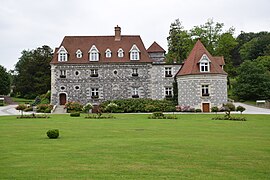
Places of interest[]
- A sixteenth century priory.
- A sixteenth century manorhouse, once the mairie.
See also[]
- Communes of the Seine-Maritime department
References[]
- ^ "Répertoire national des élus: les maires". data.gouv.fr, Plateforme ouverte des données publiques françaises (in French). 2 December 2020.
- ^ "Populations légales 2018". INSEE. 28 December 2020.
- ^ Population en historique depuis 1968, INSEE
| Wikimedia Commons has media related to Rouxmesnil-Bouteilles. |
| show Communes of the Seine-Maritime department |
|---|
| show Authority control |
|---|
Categories:
- Communes of Seine-Maritime
- Dieppe geography stubs