Saint-Jean-du-Cardonnay
Saint-Jean-du-Cardonnay | |
|---|---|
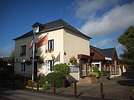 The town hall in Saint-Jean-du-Cardonnay | |
 Coat of arms | |
show Location of Saint-Jean-du-Cardonnay | |
 Saint-Jean-du-Cardonnay | |
| Coordinates: 49°30′25″N 1°00′36″E / 49.5069°N 1.01°ECoordinates: 49°30′25″N 1°00′36″E / 49.5069°N 1.01°E | |
| Country | France |
| Region | Normandy |
| Department | Seine-Maritime |
| Arrondissement | Rouen |
| Canton | Notre-Dame-de-Bondeville |
| Government | |
| • Mayor (2020–2026) | Jacques Niel[1] |
| Area 1 | 7.52 km2 (2.90 sq mi) |
| Population (Jan. 2018)[2] | 1,364 |
| • Density | 180/km2 (470/sq mi) |
| Time zone | UTC+01:00 (CET) |
| • Summer (DST) | UTC+02:00 (CEST) |
| INSEE/Postal code | 76594 /76150 |
| Elevation | 55–146 m (180–479 ft) (avg. 130 m or 430 ft) |
| 1 French Land Register data, which excludes lakes, ponds, glaciers > 1 km2 (0.386 sq mi or 247 acres) and river estuaries. | |


Saint-Jean-du-Cardonnay is a commune in the Seine-Maritime department in the Normandy region in northern France.
Geography[]
A village of forestry and farming situated in the Roumois, just 7 miles (11 km) northwest of the centre of Rouen at the junction of the D90, D267 with the D6015 road.
Population[]
| Year | Pop. | ±% p.a. |
|---|---|---|
| 1968 | 773 | — |
| 1975 | 1,015 | +3.97% |
| 1982 | 1,094 | +1.08% |
| 1990 | 1,270 | +1.88% |
| 1999 | 1,298 | +0.24% |
| 2007 | 1,345 | +0.45% |
| 2012 | 1,352 | +0.10% |
| 2017 | 1,377 | +0.37% |
| Source: INSEE[3] | ||
Places of interest[]
- The church of St.Jean, dating from the sixteenth century.
- A seventeenth-century chateau.
- A chapel built in 1820.
See also[]
- Communes of the Seine-Maritime department
References[]
- ^ Liste des maires du département de la Seine-Maritime, 10 August 2020
- ^ "Populations légales 2018". INSEE. 28 December 2020.
- ^ Population en historique depuis 1968, INSEE
| Wikimedia Commons has media related to Saint-Jean-du-Cardonnay. |
| show Communes of the Seine-Maritime department |
|---|
Categories:
- Communes of Seine-Maritime
- Rouen geography stubs