Vieux-Manoir
Vieux-Manoir | |
|---|---|
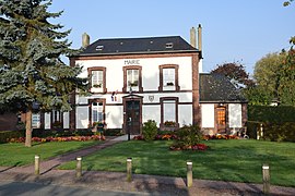 The town hall in Vieux-Manoir | |
 Coat of arms | |
show Location of Vieux-Manoir | |
 Vieux-Manoir | |
| Coordinates: 49°34′04″N 1°17′55″E / 49.5678°N 1.2986°ECoordinates: 49°34′04″N 1°17′55″E / 49.5678°N 1.2986°E | |
| Country | France |
| Region | Normandy |
| Department | Seine-Maritime |
| Arrondissement | Rouen |
| Canton | Le Mesnil-Esnard |
| Government | |
| • Mayor (2020–2026) | Fabrice Otero[1] |
| Area 1 | 8.13 km2 (3.14 sq mi) |
| Population (Jan. 2018)[2] | 746 |
| • Density | 92/km2 (240/sq mi) |
| Time zone | UTC+01:00 (CET) |
| • Summer (DST) | UTC+02:00 (CEST) |
| INSEE/Postal code | 76738 /76750 |
| Elevation | 143–189 m (469–620 ft) (avg. 173 m or 568 ft) |
| 1 French Land Register data, which excludes lakes, ponds, glaciers > 1 km2 (0.386 sq mi or 247 acres) and river estuaries. | |


Vieux-Manoir is a commune in the Seine-Maritime department in the Normandy region in northern France.
Geography[]
A village of farming and associated light industry situated in the Pays de Bray, some 15 miles (24 km) northeast of Rouen near the junction of the D206 with the D122 road. The A28 autoroute forms the western border of the commune and SNCF operates a TER railway service here.
Population[]
| Year | 1962 | 1968 | 1975 | 1982 | 1990 | 1999 | 2006 |
|---|---|---|---|---|---|---|---|
| Population | 277 | 280 | 340 | 609 | 599 | 650 | 703 |
| From the year 1962 on: No double counting—residents of multiple communes (e.g. students and military personnel) are counted only once. | |||||||
Places of interest[]
- The church of Notre-Dame, dating from the sixteenth century.
See also[]
- Communes of the Seine-Maritime department
References[]
- ^ "Répertoire national des élus: les maires". data.gouv.fr, Plateforme ouverte des données publiques françaises (in French). 2 December 2020.
- ^ "Populations légales 2018". INSEE. 28 December 2020.
| Wikimedia Commons has media related to Vieux-Manoir. |
| show Communes of the Seine-Maritime department |
|---|
Categories:
- Communes of Seine-Maritime
- Rouen geography stubs