Araç
Araç | |
|---|---|
District | |
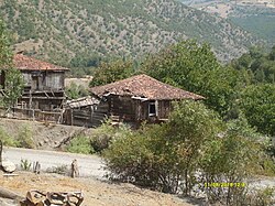 Sarıhacı village in Araç | |
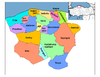
 Location of Araç within Turkey. | |
 Araç Location of Araç | |
| Coordinates: 41°15′N 33°20′E / 41.250°N 33.333°E | |
| Country | |
| Region | Black Sea |
| Province | Kastamonu |
| Government | |
| • Mayor | Satılmış SARIKAYA (CHP) |
| Area | |
| • District | 1,641.57 km2 (633.81 sq mi) |
| Elevation | 740 m (2,430 ft) |
| Population (2012)[2] | |
| • Urban | 5,986 |
| • District | 19,337 |
| • District density | 12/km2 (31/sq mi) |
| Time zone | UTC+2 (EET) |
| • Summer (DST) | UTC+3 (EEST) |
| Postal code | 37xxx |
| Area code(s) | 366 |
| Licence plate | 37 |
| Climate | Cfb |
| Website | www.arac.bel.tr |

Araç is a town and district of the Kastamonu Province in the Black Sea region of Turkey. According to the 2010 census, the population of the district is 20,002, of which 5,860 residents live in the town of Araç.[3][4] The district covers an area of 1,642 km2 (634 sq mi),[5] and the town lies at an elevation of 740 m (2,428 ft).
Notes[]
- ^ "Area of regions (including lakes), km²". Regional Statistics Database. Turkish Statistical Institute. 2002. Retrieved 2013-03-05.
- ^ "Population of province/district centers and towns/villages by districts - 2012". Address Based Population Registration System (ABPRS) Database. Turkish Statistical Institute. Retrieved 2013-02-27.
- ^ Statistical Institute[permanent dead link]
- ^ GeoHive. "Statistical information on Turkey's administrative units". Archived from the original on 2009-10-15. Retrieved 2008-11-22.
- ^ Statoids. "Statistical information on districts of Turkey". Retrieved 2008-11-22.
References[]
- Falling Rain Genomics, Inc. "Geographical information on Araç, Turkey". Retrieved 2008-11-08.
External links[]
![]() Media related to Araç at Wikimedia Commons
Media related to Araç at Wikimedia Commons
- District governor's official website (in Turkish)
| show Araç in Kastamonu Province of Turkey |
|---|
| show |
|---|
| show Authority control |
|---|
Coordinates: 41°14′32″N 33°19′42″E / 41.24222°N 33.32833°E
This geographical article about a location in Kastamonu Province, Turkey is a stub. You can help Wikipedia by . |
Categories:
- Populated places in Kastamonu Province
- Districts of Kastamonu Province
- Kastamonu Province geography stubs