Doğanyurt
- See also Doğanyurt, Çine, a village in Aydin province, Turkey.
Doğanyurt | |
|---|---|
District | |
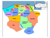
 Location of Doğanyurt within Turkey. | |
 Doğanyurt Location of Doğanyurt | |
| Coordinates: 42°00′N 33°27′E / 42.000°N 33.450°E | |
| Country | |
| Region | Black Sea |
| Province | Kastamonu |
| Government | |
| • Mayor | Ahmet Kaya (AKP) |
| Area | |
| • District | 253.53 km2 (97.89 sq mi) |
| Elevation | 235 m (771 ft) |
| Population (2012)[2] | |
| • Urban | 1,246 |
| • District | 7,038 |
| • District density | 28/km2 (72/sq mi) |
| Time zone | UTC+2 (EET) |
| • Summer (DST) | UTC+3 (EEST) |
| Postal code | 37xxx |
| Area code(s) | 366 |
| Licence plate | 37 |
| Climate | Cfb |
| Website | www.doganyurt.bel.tr |

Doğanyurt, formerly Hoşalay, is a town and district of the Kastamonu Province in the Black Sea region of Turkey. According to the 2000 census, population of the district is 9,668 of which 1,470 live in the town of Doğanyurt.[3][4] The district covers an area of 254 km2 (98 sq mi),[5] and the town lies at an elevation of 235 m (771 ft).
Kerembe Burnu, the ancient Cape Karambis, is located to the northwest of Doğanyurt. The promontory, 225 km distant from the Sarych headland, is the nearest point on the Anatolian coast to the Crimean Peninsula and has for centuries served as a nautical landmark for those seeking to cross the Black Sea at its narrowest point.[6]
Notes[]
- ^ "Area of regions (including lakes), km²". Regional Statistics Database. Turkish Statistical Institute. 2002. Retrieved 2013-03-05.
- ^ "Population of province/district centers and towns/villages by districts - 2012". Address Based Population Registration System (ABPRS) Database. Turkish Statistical Institute. Retrieved 2013-02-27.
- ^ Turkish Statistical Institute. "Census 2000, Key statistics for urban areas of Turkey" (in Turkish). Archived from the original (XLS) on 2007-07-22. Retrieved 2008-11-01.
- ^ GeoHive. "Statistical information on Turkey's administrative units". Retrieved 2008-11-27.
- ^ Statoids. "Statistical information on districts of Turkey". Retrieved 2008-11-27.
- ^ Anthony Bryer and David Winfield, The Byzantine Monuments and Topography of the Pontos, vol. 1, (Washington D.C.: Dumbarton Oaks, 1985), p. 67.
References[]
- Falling Rain Genomics, Inc. "Geographical information on Doğanyurt, Turkey". Retrieved 2008-11-01.
External links[]
- District governor's official website (in Turkish)
Coordinates: 42°00′00″N 33°27′00″E / 42.00000°N 33.45000°E
This geographical article about a location in Kastamonu Province, Turkey is a stub. You can help Wikipedia by . |
- Populated places in Kastamonu Province
- Fishing communities in Turkey
- Populated coastal places in Turkey
- Districts of Kastamonu Province
- Kastamonu Province geography stubs