Tosya
Tosya | |
|---|---|
District | |
 Kilkuyu village in Tosya | |
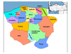
 Location of Tosya district within Turkey | |
 Tosya Location of Tosya (town) | |
| Coordinates: 41°06′N 34°02′E / 41.100°N 34.033°E | |
| Country | |
| Region | Black Sea |
| Province | Kastamonu |
| Government | |
| • Mayor | Kazım Şahin (AKP) |
| Area | |
| • District | 1,185.62 km2 (457.77 sq mi) |
| Elevation | 1,231 m (4,039 ft) |
| Population (2012)[2] | |
| • Urban | 28,097 |
| • District | 40,547 |
| • District density | 34/km2 (89/sq mi) |
| Time zone | UTC+2 (EET) |
| • Summer (DST) | UTC+3 (EEST) |
| Postal code | 37300 |
| Area code(s) | 366 |
| Licence plate | 37 |
| Climate | Cfb |
| Website | www |

Tosya (Ottoman Turkish: طوسيه), previously called Theodosia (Greek: Θεοδοσία) or Dokeia (Greek: Δοκεία) under the Byzantine Empire, is a town and district of Kastamonu Province in the Black Sea region of Turkey. According to the 2000 census, the population of the district is 41,995. [3] About 30,000 live in the town of Tosya. The district covers an area of 1,186 km2 (458 sq mi),[4] and the town lies at an elevation of 1,231 m (4,039 ft). The district produces a third of Turkey's total rice harvest. Timber is another important industry in Tosya. It is the home town of the famous Boyner family and the birth place of Markos Vafiadis (born 1906), a famous Greek politician.
The North Anatolian Fault is located in this area.[5] This caused a major earthquake in 1943.
Notes[]
- ^ "Area of regions (including lakes), km²". Regional Statistics Database. Turkish Statistical Institute. 2002. Retrieved 2013-03-05.
- ^ "Population of province/district centers and towns/villages by districts - 2012". Address Based Population Registration System (ABPRS) Database. Turkish Statistical Institute. Retrieved 2013-02-27.
- ^ Turkish Statistical Institute. "Census 2000, Key statistics for urban areas of Turkey" (XLS) (in Turkish). Retrieved 2008-11-03.
- ^ Statoids. "Statistical information on districts of Turkey". Retrieved 2008-11-28.
- ^ Dhonta, Damien. “Polyphased block tectonics along the North Anatolian Fault in the Tosya basin area (Turkey)”, Tectonophysics (journal), Volume 299, 20 December 1998, Pages 213-227.
References[]
- Falling Rain Genomics, Inc. "Geographical information on Tosya, Turkey". Retrieved 2008-11-03.
External links[]
![]() Media related to Tosya at Wikimedia Commons
Media related to Tosya at Wikimedia Commons
- Tosya Municipality (in Turkish)
- District governorship official website (in Turkish)
| show Tosya in Kastamonu Province of Turkey |
|---|
| show |
|---|
Coordinates: 41°05′50″N 34°02′13″E / 41.09722°N 34.03694°E
| Authority control |
|---|
This geographical article about a location in Kastamonu Province, Turkey is a stub. You can help Wikipedia by . |
- Populated places in Kastamonu Province
- Districts of Kastamonu Province
- Kastamonu Province geography stubs