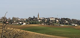
Cadours
Cadours | |
|---|---|
 Cadours | |
 Coat of arms | |
show Location of Cadours | |
 Cadours | |
| Coordinates: 43°43′45″N 1°03′02″E / 43.7292°N 1.0506°ECoordinates: 43°43′45″N 1°03′02″E / 43.7292°N 1.0506°E | |
| Country | France |
| Region | Occitanie |
| Department | Haute-Garonne |
| Arrondissement | Toulouse |
| Canton | Léguevin |
| Intercommunality | Hauts Tolosans |
| Government | |
| • Mayor (2020–2026) | Didier Laffont |
| Area 1 | 10.58 km2 (4.08 sq mi) |
| Population (Jan. 2018)[1] | 1,087 |
| • Density | 100/km2 (270/sq mi) |
| Time zone | UTC+01:00 (CET) |
| • Summer (DST) | UTC+02:00 (CEST) |
| INSEE/Postal code | 31098 /31480 |
| Elevation | 147–242 m (482–794 ft) (avg. 250 m or 820 ft) |
| 1 French Land Register data, which excludes lakes, ponds, glaciers > 1 km2 (0.386 sq mi or 247 acres) and river estuaries. | |


Cadours (French pronunciation: [kaduʁ]; Occitan: Cadors) is a commune in the Haute-Garonne department in southwestern France. The town hosted the Circuit de Cadours between 1948 and 1961.
Population[]
| Year | Pop. | ±% |
|---|---|---|
| 1962 | 687 | — |
| 1968 | 737 | +7.3% |
| 1975 | 776 | +5.3% |
| 1982 | 687 | −11.5% |
| 1990 | 694 | +1.0% |
| 1999 | 696 | +0.3% |
| 2008 | 1,045 | +50.1% |
Monuments[]
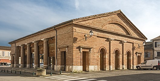
Market hall.

Inside the market hall.

The church.

The War Memorial.


See also[]
References[]
- ^ "Populations légales 2018". INSEE. 28 December 2020.
| Wikimedia Commons has media related to Cadours. |
This Haute-Garonne geographical article is a stub. You can help Wikipedia by . |
Categories:
- Communes of Haute-Garonne
- Haute-Garonne geography stubs