Champagne-sur-Loue
Champagne-sur-Loue | |
|---|---|
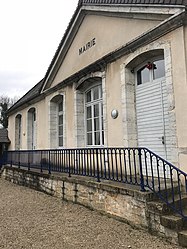 The town hall in Champagne-sur-Loue | |
show Location of Champagne-sur-Loue | |
 Champagne-sur-Loue | |
| Coordinates: 47°02′24″N 5°48′50″E / 47.04°N 5.8139°ECoordinates: 47°02′24″N 5°48′50″E / 47.04°N 5.8139°E | |
| Country | France |
| Region | Bourgogne-Franche-Comté |
| Department | Jura |
| Arrondissement | Dole |
| Canton | Mont-sous-Vaudrey |
| Government | |
| • Mayor (2020–2026) | Marie-Christine Paillot |
| Area 1 | 3.77 km2 (1.46 sq mi) |
| Population (Jan. 2018)[1] | 125 |
| • Density | 33/km2 (86/sq mi) |
| Time zone | UTC+01:00 (CET) |
| • Summer (DST) | UTC+02:00 (CEST) |
| INSEE/Postal code | 39095 /39600 |
| Elevation | 231–342 m (758–1,122 ft) |
| 1 French Land Register data, which excludes lakes, ponds, glaciers > 1 km2 (0.386 sq mi or 247 acres) and river estuaries. | |


Champagne-sur-Loue (French pronunciation: [ʃɑ̃paɲ syʁ lu], literally Champagne on Loue) is a commune in the Jura department in Bourgogne-Franche-Comté in eastern France.
Population[]
|
|
See also[]
References[]
- ^ "Populations légales 2018". INSEE. 28 December 2020.
| Wikimedia Commons has media related to Champagne-sur-Loue. |
This Jura geographical article is a stub. You can help Wikipedia by . |
Categories:
- Communes of Jura (department)
- Jura (department) geography stubs