Clarac, Haute-Garonne
Clarac | |
|---|---|
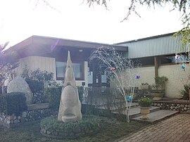 The town hall in Clarac | |
show Location of Clarac | |
 Clarac | |
| Coordinates: 43°05′50″N 0°37′36″E / 43.0972°N 0.6267°ECoordinates: 43°05′50″N 0°37′36″E / 43.0972°N 0.6267°E | |
| Country | France |
| Region | Occitanie |
| Department | Haute-Garonne |
| Arrondissement | Saint-Gaudens |
| Canton | Saint-Gaudens |
| Government | |
| • Mayor (2020–2026) | Jean-Paul Manent[1] |
| Area 1 | 4.74 km2 (1.83 sq mi) |
| Population (Jan. 2018)[2] | 644 |
| • Density | 140/km2 (350/sq mi) |
| Time zone | UTC+01:00 (CET) |
| • Summer (DST) | UTC+02:00 (CEST) |
| INSEE/Postal code | 31147 /31210 |
| Elevation | 387–515 m (1,270–1,690 ft) (avg. 300 m or 980 ft) |
| 1 French Land Register data, which excludes lakes, ponds, glaciers > 1 km2 (0.386 sq mi or 247 acres) and river estuaries. | |


Clarac (French pronunciation: [klaʁak]) is a commune in the Haute-Garonne department in southwestern France.
Population[]
| Year | Pop. | ±% |
|---|---|---|
| 1962 | 137 | — |
| 1968 | 167 | +21.9% |
| 1975 | 189 | +13.2% |
| 1982 | 255 | +34.9% |
| 1990 | 452 | +77.3% |
| 1999 | 508 | +12.4% |
| 2008 | 563 | +10.8% |
See also[]
References[]
- ^ "Répertoire national des élus: les maires". data.gouv.fr, Plateforme ouverte des données publiques françaises (in French). 2 December 2020.
- ^ "Populations légales 2018". INSEE. 28 December 2020.
| Wikimedia Commons has media related to Clarac (Haute-Garonne). |
This Haute-Garonne geographical article is a stub. You can help Wikipedia by . |
Categories:
- Communes of Haute-Garonne
- Haute-Garonne geography stubs