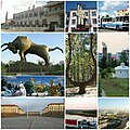
Ewenki Autonomous Banner
Ewenki Banner
| |
|---|---|
Autonomous banner | |
| Ewenki Autonomous Banner 鄂温克族自治旗 ᠡᠸᠡᠩᠬᠢᠥᠪᠡᠷᠲᠡᠭᠡᠨᠵᠠᠰᠠᠬᠤᠬᠣᠰᠢᠭᠤ ᠧᠸᠧᠩᠺᠢᠠᠶᠢᠮᠠᠨᠨᠢᠮᠧᠧᠨᠵᠢᠵᠣᠬᠠᠷᠭᠣᠰ | |
 | |
 Ewenki Banner in Hulunbuir | |
 Hulunbuir in Inner Mongolia | |
| Coordinates (Ewenki Banner government): 49°08′48″N 119°45′19″E / 49.1468°N 119.7552°ECoordinates: 49°08′48″N 119°45′19″E / 49.1468°N 119.7552°E | |
| Country | People's Republic of China |
| Region | Inner Mongolia |
| Prefecture-level city | Hulunbuir |
| Area | |
| • Total | 19,111 km2 (7,379 sq mi) |
| Population (2019)[1] | |
| • Total | 136,832 |
| • Density | 7.2/km2 (19/sq mi) |
| Time zone | UTC+8 (China Standard) |
| Postal code | 021100 |

Ewenki Autonomous Banner (Evenki:  , Ewengki Aimanni Mvvngkeng Isihēr Gosa, Эвенки Аймани Мвенкен Исихер Госа; Mongolian: ᠡᠸᠡᠩᠬᠢ ᠥᠪᠡᠷᠲᠡᠭᠡᠨ ᠵᠠᠰᠠᠬᠤ ᠬᠣᠰᠢᠭᠤ, Eveŋki öbertegen jasaqu qosiɣu, Эвэнк өөртөө засах хошуу; simplified Chinese: 鄂温克族自治旗; traditional Chinese: 鄂溫克族自治旗; pinyin: Èwēnkèzú Zìzhìqí) is an autonomous banner that lies on the border between northwestern Greater Khingan and Hulun Buir grasslands and directly south of the urban district of Hailar in the prefecture-level city of Hulunbuir, People's Republic of China.[1] The autonomous banner has an area of 19,111 km2 (7,379 sq mi),[1] and a population of 136,832 as of 2019.[2]:20–1 The banner's seat of government is the town of .[1] The most populous town in the banner is (Mongolian:
 ![]() ; Chinese: 大雁镇), which was once Dayan Mining Area (Mongolian:
; Chinese: 大雁镇), which was once Dayan Mining Area (Mongolian: ![]() ; simplified Chinese: 大雁矿区; traditional Chinese: 大雁礦區; pinyin: Dàyàn Kuàng Qū) as an administrative division and is now the main part of an industrial district also named Dayan Mining Area, has an area of 443 square kilometres (171 sq mi) and a population of about 73,000.[citation needed][clarification needed]
; simplified Chinese: 大雁矿区; traditional Chinese: 大雁礦區; pinyin: Dàyàn Kuàng Qū) as an administrative division and is now the main part of an industrial district also named Dayan Mining Area, has an area of 443 square kilometres (171 sq mi) and a population of about 73,000.[citation needed][clarification needed]
Administrative divisions[]
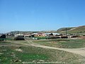
The banner is divided into 4 towns, 1 ethnic township, and 5 sumu: , , , , , , , , , and .[1][3][4] These subdivisions are further divided into 44 and 20 Residential Communities.[1] The banner's seat of government is the town of Bayan Tohoi.[1]
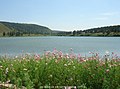
Geography[]

The overwhelming majority of the banner's area is grassland, although the banner also includes a sizable amount of woodlands.[1][4] The banner experiences an average annual precipitation of 315 mm (12.4 in), and an average annual temperature of −2.4 °C (27.7 °F).[4]
Economy[]
A number of local state-run enterprises are located in Ewenki Autonomous Banner, many of which deal with natural resources such as coal and lumber.[1] These enterprises include Huaneng Yimin Coal and Electricity Company, which produces thermal and photovoltaic electricity,[5] Shenhua Dayan Energy Group, and Inner Mongolia Tongda Coal Industry Corporation.[1]
Ewenki Autonomous Banner's gross domestic product totaled 10.69273 billion renminbi (RMB) as of 2019, a 2.3% increase from 2018.[2]:20–30 Of this, 8.47% came from the autonomous banner's primary sector, 55.16% came from the secondary sector, and 36.37% came from the tertiary sector.[2]:20–30
In 2019, households in the autonomous banner earned an average annual disposable income of 33,168 RMB.[2]:20–30 The autonomous banner's urban households earned an average of 33,214 RMB in disposable income, ranking 58th out of the 101 county-level divisions in Inner Mongolia for which this statistic was reported;[2]:20–5 and rural households in the autonomous banner earned an average of 24,926 RMB in disposable income, ranking 9th out of the 90 county-level divisions for which this statistic was reported.[2]:20–6
Consumer retail sales in the autonomous banner totaled 2.06048 billion RMB as of 2019.[2]:20–30
As of 2019, there were 21,204 mobile telephone subscriptions in the Ewenki Autonomous Banner, accounting for 14.50% of its total population, and 29,769 internet subscriptions, accounting for 21.76% of its total population.[2]:20–30
In 2019, Ewenki Autonomous Banner earned 736.62 million RMB in public budget revenue, ranking 40th out of the 103 county-level divisions in Inner Mongolia.[2]:20–4
Agriculture[]
Ewenki Autonomous Banner produced 49,145 tons of grain in 2019, ranking 71st out of the 96 county-level divisions in Inner Mongolia which for which this statistic was reported.[2]:20–2 In the same year, the autonomous banner produced 17,749 tons of meat, ranking 57th out of Inner Mongolia's 103 county-level divisions.[2]:20–3
Demographics[]
As of 2019, the autonomous banner's population of 136,832 ranks 71st out of Inner Mongolia's 103 county-level divisions.[2]:20–1 This total was a 0.7% decline from the previous year.[2]:20–30
Ethnicity[]
The autonomous banner's government reported in 2013 that ethnic minorities within the banner totaled 58,843 people, accounting for 40.8% of the total population.[1] In addition to the Han Chinese majority in the autonomous banner,[1] sizable minority communities include the Evenki, Mongol, Daur, Manchu, Hui, Korean, Oroqen, and Sibe people.[4]
| Ethnicity | Population[1] | Percentage[1] |
|---|---|---|
| Han Chinese | ~85,157 | 59.2% |
| Mongol | 27,809 | 19.3% |
| Daur | 14,239 | 9.9% |
| Evenki | 11,193 | 7.8% |
| Others | ~5,602 | 3.8% |
Education[]
The autonomous banner has 10 primary schools and 11 secondary schools.[2]:20–30
Healthcare[]
As of 2019, Ewenki Autonomous Banner's medical institutions host 604 beds, and are staffed by 1,100 personnel.[2]:20–30
Transport[]
Ewenki Autonomous Banner is served by 1,422 kilometres (884 mi) of highway as of 2019.[2]:20–30
is crossed by the ,[4] the Harbin-Manzhouli railway,[citation needed] and highways G301 and G10.[citation needed] Hailar International Airport is the nearest airport.[citation needed]
Gallery[]
- Dayan Town
Places in

No.1 Colliery of Dayan in 1990s

Winter of Dayan


- The other Administrative Divisions in Evenk Banner

Ewenki Museum in the town of
Honghua'erji National Forest Park


References[]
- ^ Jump up to: a b c d e f g h i j k l m n o 鄂温克概况 (in Chinese). Ewenki Autonomous Banner People's Government. Archived from the original on 2020-05-31. Retrieved 2020-05-31.
- ^ Jump up to: a b c d e f g h i j k l m n o p 内蒙古统计年鉴—2020 [Inner Mongolia Statistical Yearbook 2020]. tj.mng.gov.cn (in Chinese). Inner Mongolia Autonomous Regional Bureau of Statistics. 2020. Archived from the original on 2021-07-13. Retrieved 2021-07-13.
- ^ 2019年统计用区划代码 (in Chinese). National Bureau of Statistics of the People's Republic of China. Retrieved 2020-05-31.
- ^ Jump up to: a b c d e 鄂温克族自治旗概况地图 (in Chinese). XZQH.org. 2013-04-23. Retrieved 2020-05-31.
- ^ 华能伊敏煤电有限责任公司-新华网. Xinhua. 2019-12-03. Archived from the original on 2020-05-31. Retrieved 2020-05-31.
External links[]
| Wikimedia Commons has media related to Evenk Autonomous Banner. |
| show Authority control |
|---|
- Autonomous counties of the People's Republic of China
- Hulunbuir
- County-level divisions of Inner Mongolia