Falletans
Falletans | |
|---|---|
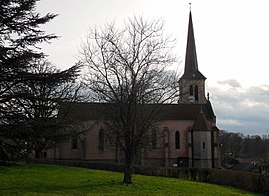 The church in Falletans | |
 Coat of arms | |
show Location of Falletans | |
 Falletans | |
| Coordinates: 47°06′12″N 5°33′47″E / 47.1033°N 5.5631°ECoordinates: 47°06′12″N 5°33′47″E / 47.1033°N 5.5631°E | |
| Country | France |
| Region | Bourgogne-Franche-Comté |
| Department | Jura |
| Arrondissement | Dole |
| Canton | Authume |
| Government | |
| • Mayor (2020–2026) | Pascal Lopez[1] |
| Area 1 | 24.35 km2 (9.40 sq mi) |
| Population (Jan. 2018)[2] | 394 |
| • Density | 16/km2 (42/sq mi) |
| Time zone | UTC+01:00 (CET) |
| • Summer (DST) | UTC+02:00 (CEST) |
| INSEE/Postal code | 39220 /39700 |
| Elevation | 200–264 m (656–866 ft) |
| 1 French Land Register data, which excludes lakes, ponds, glaciers > 1 km2 (0.386 sq mi or 247 acres) and river estuaries. | |


Falletans is a commune in the Jura department in Bourgogne-Franche-Comté in eastern France.
Population[]
|
|
See also[]
References[]
- ^ "Répertoire national des élus: les maires". data.gouv.fr, Plateforme ouverte des données publiques françaises (in French). 2 December 2020.
- ^ "Populations légales 2018". INSEE. 28 December 2020.
| Wikimedia Commons has media related to Falletans. |
This Jura geographical article is a stub. You can help Wikipedia by . |
Categories:
- Communes of Jura (department)
- Jura (department) geography stubs