Fay-en-Montagne
Fay-en-Montagne | |
|---|---|
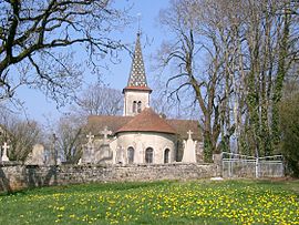 The church in Fay-en-Montagne | |
show Location of Fay-en-Montagne | |
 Fay-en-Montagne | |
| Coordinates: 46°45′10″N 5°43′33″E / 46.7528°N 5.7258°ECoordinates: 46°45′10″N 5°43′33″E / 46.7528°N 5.7258°E | |
| Country | France |
| Region | Bourgogne-Franche-Comté |
| Department | Jura |
| Arrondissement | Dole |
| Canton | Poligny |
| Government | |
| • Mayor (2020–2026) | Laurent Perrard |
| Area 1 | 6.26 km2 (2.42 sq mi) |
| Population (Jan. 2018)[1] | 82 |
| • Density | 13/km2 (34/sq mi) |
| Time zone | UTC+01:00 (CET) |
| • Summer (DST) | UTC+02:00 (CEST) |
| INSEE/Postal code | 39222 /39800 |
| Elevation | 519–567 m (1,703–1,860 ft) |
| 1 French Land Register data, which excludes lakes, ponds, glaciers > 1 km2 (0.386 sq mi or 247 acres) and river estuaries. | |


Fay-en-Montagne (French pronunciation: [fɛ ɑ̃ mɔ̃taɲ]) is a commune in the Jura department in Bourgogne-Franche-Comté in eastern France.
Population[]
|
|
See also[]
References[]
- ^ "Populations légales 2018". INSEE. 28 December 2020.
| Wikimedia Commons has media related to Fay-en-Montagne. |
| show Authority control |
|---|
This Jura geographical article is a stub. You can help Wikipedia by . |
Categories:
- Communes of Jura (department)
- Jura (department) geography stubs