Grange-de-Vaivre
Grange-de-Vaivre | |
|---|---|
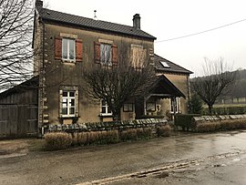 The town hall in Grange-de-Vaivre | |
show Location of Grange-de-Vaivre | |
 Grange-de-Vaivre | |
| Coordinates: 47°00′13″N 5°50′30″E / 47.0036°N 5.8417°ECoordinates: 47°00′13″N 5°50′30″E / 47.0036°N 5.8417°E | |
| Country | France |
| Region | Bourgogne-Franche-Comté |
| Department | Jura |
| Arrondissement | Dole |
| Canton | Mont-sous-Vaudrey |
| Government | |
| • Mayor (2020–2026) | Claude Masuyer[1] |
| Area 1 | 1.74 km2 (0.67 sq mi) |
| Population (Jan. 2018)[2] | 34 |
| • Density | 20/km2 (51/sq mi) |
| Time zone | UTC+01:00 (CET) |
| • Summer (DST) | UTC+02:00 (CEST) |
| INSEE/Postal code | 39259 /39600 |
| Elevation | 245–403 m (804–1,322 ft) |
| 1 French Land Register data, which excludes lakes, ponds, glaciers > 1 km2 (0.386 sq mi or 247 acres) and river estuaries. | |


Grange-de-Vaivre (French pronunciation: [ɡʁɑ̃ʒ də vɛvʁ]) is a commune in the Jura department in Bourgogne-Franche-Comté in eastern France.
Population[]
|
|
See also[]
References[]
- ^ "Répertoire national des élus: les maires". data.gouv.fr, Plateforme ouverte des données publiques françaises (in French). 2 December 2020.
- ^ "Populations légales 2018". INSEE. 28 December 2020.
| Wikimedia Commons has media related to Grange-de-Vaivre. |
This Jura geographical article is a stub. You can help Wikipedia by . |
Categories:
- Communes of Jura (department)
- Jura (department) geography stubs