Lamoura
Lamoura | |
|---|---|
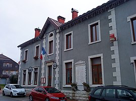 Town hall | |
show Location of Lamoura | |
 Lamoura | |
| Coordinates: 46°23′46″N 5°58′03″E / 46.3961°N 5.9675°ECoordinates: 46°23′46″N 5°58′03″E / 46.3961°N 5.9675°E | |
| Country | France |
| Region | Bourgogne-Franche-Comté |
| Department | Jura |
| Arrondissement | Saint-Claude |
| Canton | Coteaux du Lizon |
| Government | |
| • Mayor (2020–2026) | Francis Leseur[1] |
| Area 1 | 22.28 km2 (8.60 sq mi) |
| Population (Jan. 2018)[2] | 646 |
| • Density | 29/km2 (75/sq mi) |
| Time zone | UTC+01:00 (CET) |
| • Summer (DST) | UTC+02:00 (CEST) |
| INSEE/Postal code | 39275 /39310 |
| Elevation | 1,064–1,495 m (3,491–4,905 ft) |
| 1 French Land Register data, which excludes lakes, ponds, glaciers > 1 km2 (0.386 sq mi or 247 acres) and river estuaries. | |


Lamoura is a commune in the Jura department in Bourgogne-Franche-Comté in eastern France.
Population[]
|
|
See also[]
References[]
- ^ "Répertoire national des élus: les maires". data.gouv.fr, Plateforme ouverte des données publiques françaises (in French). 2 December 2020.
- ^ "Populations légales 2018". INSEE. 28 December 2020.
| Wikimedia Commons has media related to Lamoura. |
This Jura geographical article is a stub. You can help Wikipedia by . |
Categories:
- Communes of Jura (department)
- Jura (department) geography stubs