Lapeyrouse-Fossat
Lapeyrouse-Fossat
La Peirosa (Occitan) | |
|---|---|
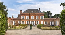 Chateau | |
 Coat of arms | |
show Location of Lapeyrouse-Fossat | |
 Lapeyrouse-Fossat | |
| Coordinates: 43°41′34″N 1°31′02″E / 43.6928°N 1.5172°ECoordinates: 43°41′34″N 1°31′02″E / 43.6928°N 1.5172°E | |
| Country | France |
| Region | Occitanie |
| Department | Haute-Garonne |
| Arrondissement | Toulouse |
| Canton | Pechbonnieu |
| Intercommunality | Coteaux du Girou |
| Government | |
| • Mayor (2020–2026) | Corinne Gonzalez |
| Area 1 | 9.49 km2 (3.66 sq mi) |
| Population (Jan. 2018)[1] | 2,854 |
| • Density | 300/km2 (780/sq mi) |
| Time zone | UTC+01:00 (CET) |
| • Summer (DST) | UTC+02:00 (CEST) |
| INSEE/Postal code | 31273 /31180 |
| Elevation | 132–215 m (433–705 ft) (avg. 195 m or 640 ft) |
| 1 French Land Register data, which excludes lakes, ponds, glaciers > 1 km2 (0.386 sq mi or 247 acres) and river estuaries. | |


Lapeyrouse-Fossat (French pronunciation: [lapeʁuz fosa]; Occitan: La Peirosa e Le Fossat) is a commune in the Haute-Garonne department in southwestern France.
Population[]
| Year | Pop. | ±% |
|---|---|---|
| 1962 | 493 | — |
| 1968 | 607 | +23.1% |
| 1975 | 894 | +47.3% |
| 1982 | 1,295 | +44.9% |
| 1990 | 1,596 | +23.2% |
| 1999 | 2,056 | +28.8% |
| 2005 | 2,373 | +15.4% |
| 2008 | 2,599 | +9.5% |
| 2010 | 2,686 | +3.3% |
| 2015 | 2,753 | +2.5% |
| 2018 | 2,854 | +3.7% |
The inhabitants of the commune are known as Lapeyrousiens and Lapeyrousiennes.
See also[]
References[]
- ^ "Populations légales 2018". INSEE. 28 December 2020.
| Wikimedia Commons has media related to Lapeyrouse-Fossat. |
This Haute-Garonne geographical article is a stub. You can help Wikipedia by . |
Categories:
- Communes of Haute-Garonne
- Haute-Garonne geography stubs