Launaguet
Launaguet | |
|---|---|
 Château de Launaguet - Current City Hall. | |
 Coat of arms | |
show Location of Launaguet | |
 Launaguet | |
| Coordinates: 43°40′30″N 1°27′28″E / 43.675°N 1.4578°ECoordinates: 43°40′30″N 1°27′28″E / 43.675°N 1.4578°E | |
| Country | France |
| Region | Occitanie |
| Department | Haute-Garonne |
| Arrondissement | Toulouse |
| Canton | Toulouse-8 |
| Intercommunality | Toulouse Métropole |
| Government | |
| • Mayor (2020–2026) | Michel Rougé |
| Area 1 | 7.02 km2 (2.71 sq mi) |
| Population (Jan. 2018)[1] | 8,942 |
| • Density | 1,300/km2 (3,300/sq mi) |
| Time zone | UTC+01:00 (CET) |
| • Summer (DST) | UTC+02:00 (CEST) |
| INSEE/Postal code | 31282 /31140 |
| Elevation | 126–203 m (413–666 ft) (avg. 135 m or 443 ft) |
| 1 French Land Register data, which excludes lakes, ponds, glaciers > 1 km2 (0.386 sq mi or 247 acres) and river estuaries. | |


Launaguet (French pronunciation: [lonaɡɛ]; Occitan: Launaguet) is a commune in the Haute-Garonne department in southwestern France.
Population[]
| Year | Pop. | ±% |
|---|---|---|
| 1962 | 1,160 | — |
| 1968 | 1,407 | +21.3% |
| 1975 | 2,771 | +96.9% |
| 1982 | 2,842 | +2.6% |
| 1990 | 3,768 | +32.6% |
| 1999 | 5,086 | +35.0% |
| 2006 | 6,696 | +31.7% |
| 2007 | 6,926 | +3.4% |
| 2008 | 6,953 | +0.4% |
| 2012 | 7,469 | +7.4% |
| 2015 | 8,247 | +10.4% |
| 2017 | 8,880 | +7.7% |
| 2018 | 8,942 | +0.7% |
The inhabitants of the commune are known as Launaguetois or Launaguetoises.
Sights[]

Chateau facade
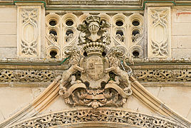
Chateau entrance

Saint Barthélemy apse
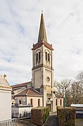
Bell tower


Twin towns[]
Launaguet is twinned with:
 Orăștie, Romania
See also[]
References[]
- ^ "Populations légales 2018". INSEE. 28 December 2020.
| Wikimedia Commons has media related to Launaguet. |
This Haute-Garonne geographical article is a stub. You can help Wikipedia by . |
Categories:
- Communes of Haute-Garonne
- Haute-Garonne geography stubs