Les Crozets
show This article may be expanded with text translated from the corresponding article in French. (July 2014) Click [show] for important translation instructions. |
Les Crozets | |
|---|---|
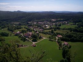 The village from upon | |
show Location of Les Crozets | |
 Les Crozets | |
| Coordinates: 46°27′40″N 5°47′42″E / 46.4611°N 5.795°ECoordinates: 46°27′40″N 5°47′42″E / 46.4611°N 5.795°E | |
| Country | France |
| Region | Bourgogne-Franche-Comté |
| Department | Jura |
| Arrondissement | Saint-Claude |
| Canton | Moirans-en-Montagne |
| Government | |
| • Mayor (2020–2026) | Catherine Schaeffer |
| Area 1 | 7.59 km2 (2.93 sq mi) |
| Population (Jan. 2018)[1] | 196 |
| • Density | 26/km2 (67/sq mi) |
| Time zone | UTC+01:00 (CET) |
| • Summer (DST) | UTC+02:00 (CEST) |
| INSEE/Postal code | 39184 /39260 |
| Elevation | 720–1,064 m (2,362–3,491 ft) |
| 1 French Land Register data, which excludes lakes, ponds, glaciers > 1 km2 (0.386 sq mi or 247 acres) and river estuaries. | |


Les Crozets (French pronunciation: [le kʁɔzɛ]) is a commune in the Jura department in Bourgogne-Franche-Comté in eastern France.
Population[]
|
|
Sites and monuments[]
- Church of St. Anthony;
- Fountains (10);
- Old toy factory, today a plastics factory
- Mount Pelan viewpoint
See also[]
References[]
- ^ "Populations légales 2018". INSEE. 28 December 2020.
| Wikimedia Commons has media related to Les Crozets. |
This Jura geographical article is a stub. You can help Wikipedia by . |
Categories:
- Communes of Jura (department)
- Jura (department) geography stubs